MyTopo
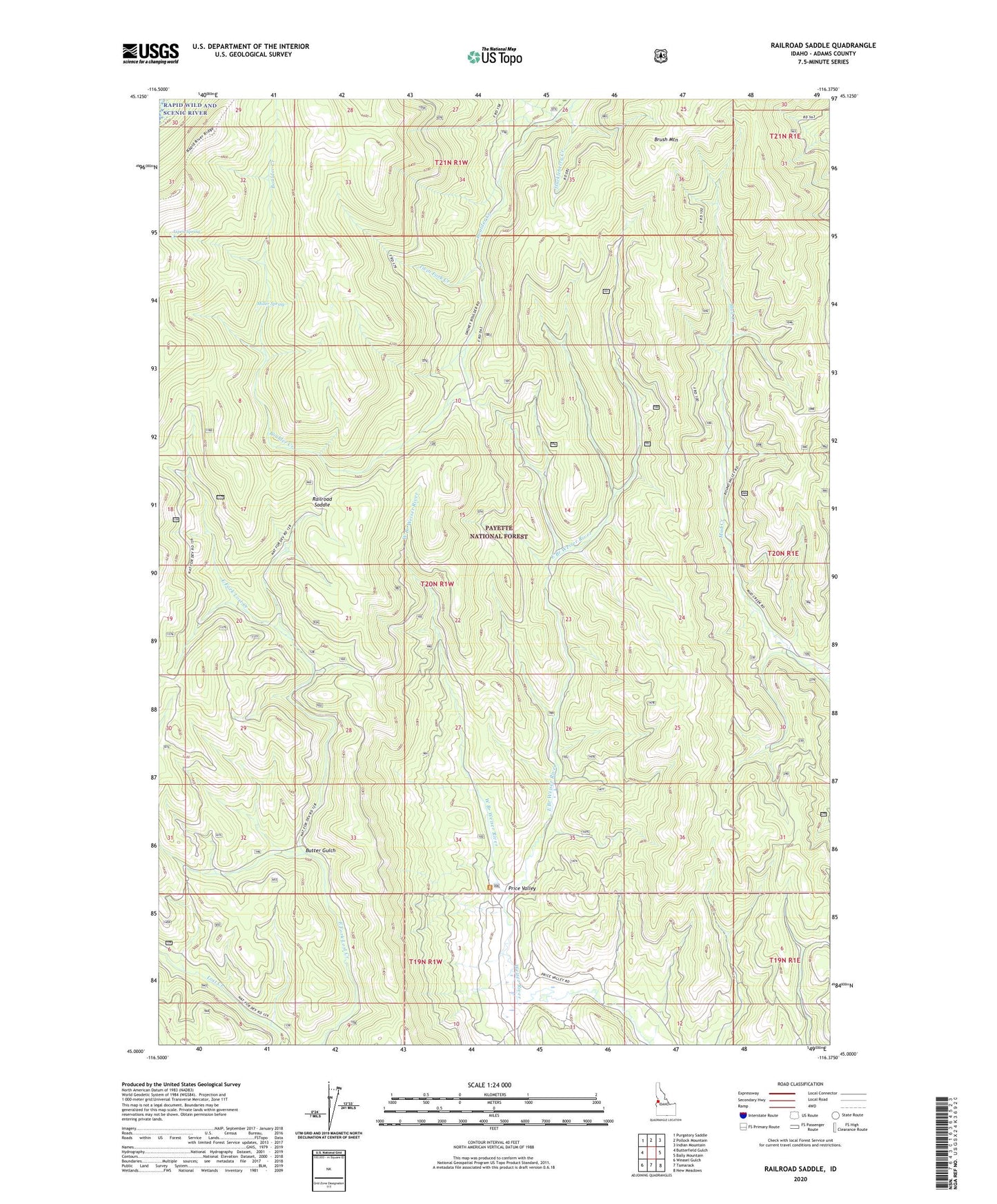
Railroad Saddle Idaho US Topo Map
Couldn't load pickup availability
Also explore the Railroad Saddle Forest Service Topo of this same quad for updated USFS data
2024 topographic map quadrangle Railroad Saddle in the state of Idaho. Scale: 1:24000. Based on the newly updated USGS 7.5' US Topo map series, this map is in the following counties: Adams. The map contains contour data, water features, and other items you are used to seeing on USGS maps, but also has updated roads and other features. This is the next generation of topographic maps. Printed on high-quality waterproof paper with UV fade-resistant inks.
Quads adjacent to this one:
West: Butterfield Gulch
Northwest: Purgatory Saddle
North: Pollock Mountain
Northeast: Indian Mountain
East: Bally Mountain
Southeast: New Meadows
South: Tamarack
Southwest: Weasel Gulch
This map covers the same area as the classic USGS quad with code o45116a4.
Contains the following named places: Ant Basin Creek, Aspen Spring, Butter Gulch, East Branch Weiser River, Huckleberry Creek, Miller Spring, Price Valley Guard Station, Railroad Saddle, Twin Fork Creek, West Branch Weiser River, Yantis Ditch