
MyTopo
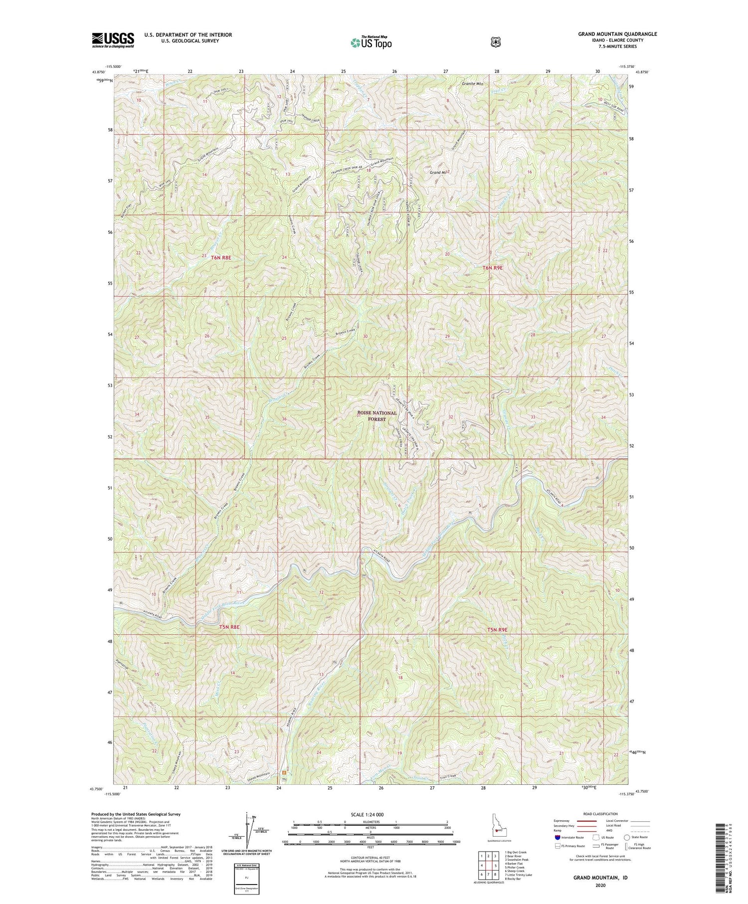
Grand Mountain Idaho US Topo Map
Couldn't load pickup availability
Also explore the Grand Mountain Forest Service Topo of this same quad for updated USFS data
2023 topographic map quadrangle Grand Mountain in the state of Idaho. Scale: 1:24000. Based on the newly updated USGS 7.5' US Topo map series, this map is in the following counties: Elmore. The map contains contour data, water features, and other items you are used to seeing on USGS maps, but also has updated roads and other features. This is the next generation of topographic maps. Printed on high-quality waterproof paper with UV fade-resistant inks.
Quads adjacent to this one:
West: Barber Flat
Northwest: Big Owl Creek
North: Bear River
Northeast: Swanholm Peak
East: Phifer Creek
Southeast: Rocky Bar
South: Little Trinity Lake
Southwest: Sheep Creek
This map covers the same area as the classic USGS quad with code o43115g4.
Contains the following named places: Browns Creek, Buck Creek, Dutch Frank Creek, Grand Mountain, Granite Creek, Granite Mountain, Lost Man Creek, Mink Creek, Pitch Creek, Roaring River, Straight Creek, Trail Creek, West Fork Lost Man Creek


