MyTopo
Chinook Mountain Idaho US Topo Map
Couldn't load pickup availability
Also explore the Chinook Mountain Forest Service Topo of this same quad for updated USFS data
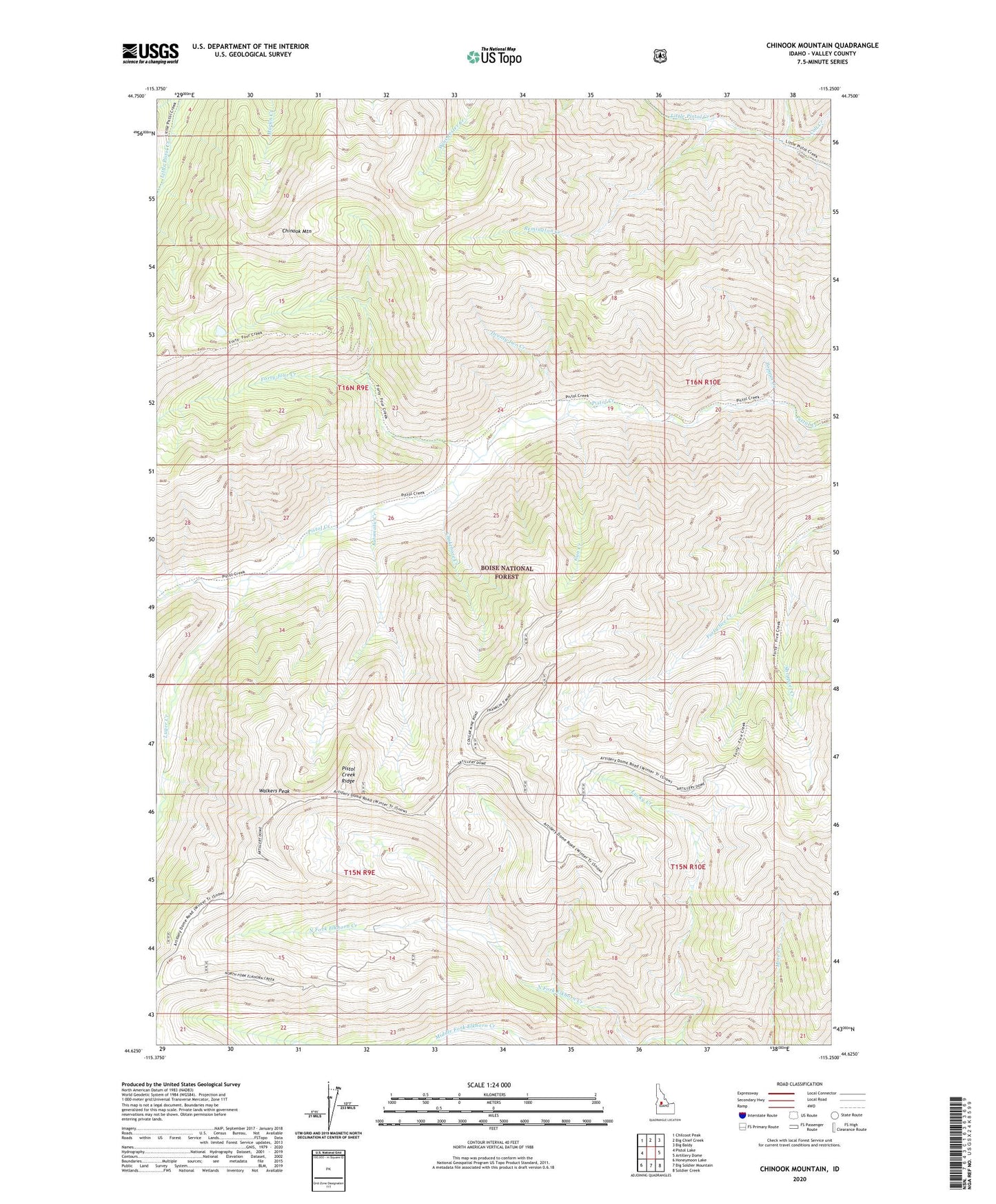
2024 topographic map quadrangle Chinook Mountain in the state of Idaho. Scale: 1:24000. Based on the newly updated USGS 7.5' US Topo map series, this map is in the following counties: Valley. The map contains contour data, water features, and other items you are used to seeing on USGS maps, but also has updated roads and other features. This is the next generation of topographic maps. Printed on high-quality waterproof paper with UV fade-resistant inks.
Quads adjacent to this one:
West: Pistol Lake
Northwest: Chilcoot Peak
North: Big Chief Creek
Northeast: Big Baldy
East: Artillery Dome
Southeast: Soldier Creek
South: Big Soldier Mountain
Southwest: Honeymoon Lake
This map covers the same area as the classic USGS quad with code o44115f3.
Contains the following named places: Automatic Creek, Chinook Mountain, Chokebore Creek, Colt Creek, Cougar Mine, Forty-four Creek, Gun Creek, Lucky Creek, Lucky Lad Mine, Luger Creek, North Fork Elkhorn Creek, Popgun Creek, Remington Creek, Shrapnel Creek, Trigger Creek, Twenty-two Creek, Walkers Peak, ZIP Code: 83611