MyTopo
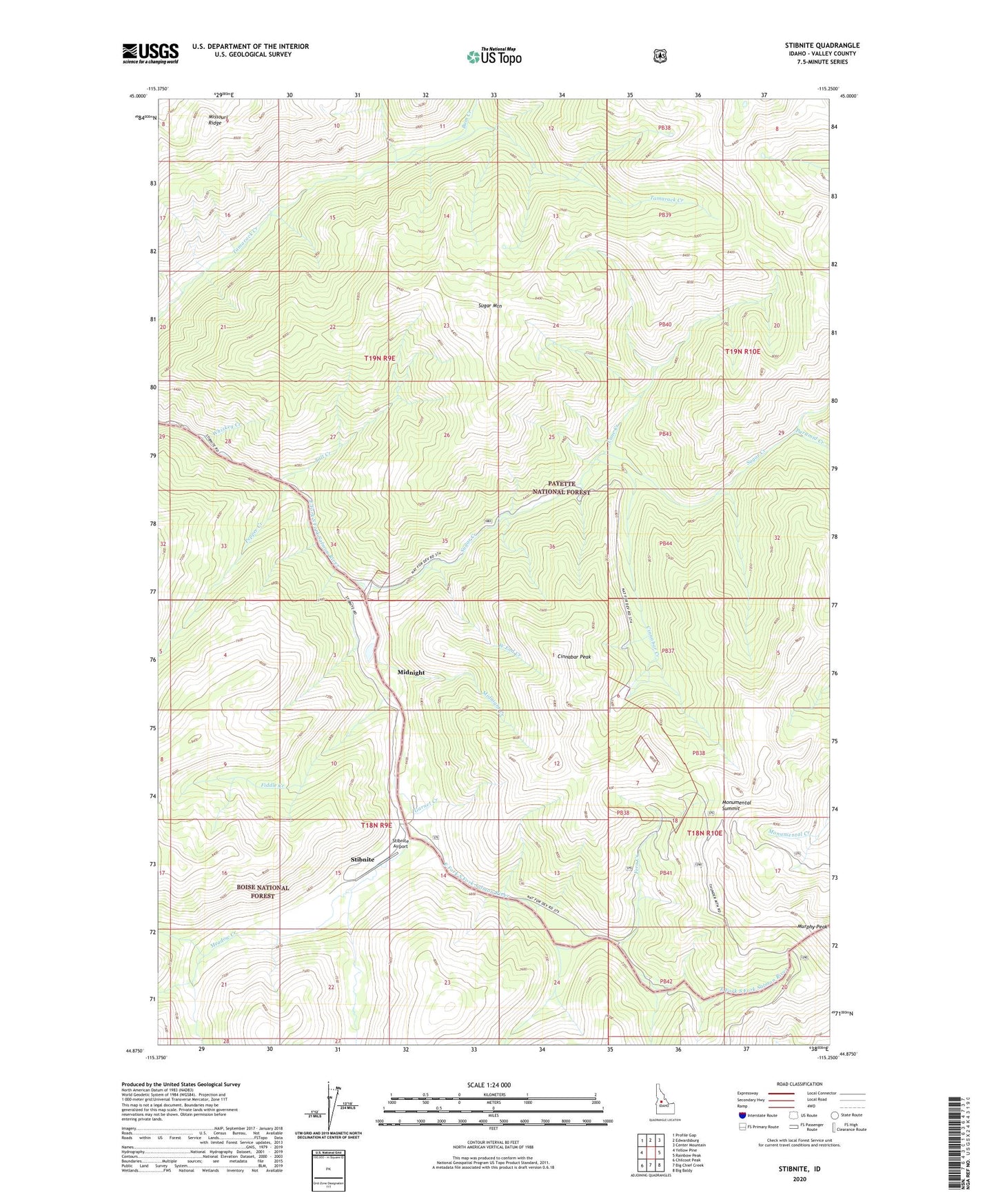
Stibnite Idaho US Topo Map
Couldn't load pickup availability
Also explore the Stibnite Forest Service Topo of this same quad for updated USFS data
2024 topographic map quadrangle Stibnite in the state of Idaho. Scale: 1:24000. Based on the newly updated USGS 7.5' US Topo map series, this map is in the following counties: Valley. The map contains contour data, water features, and other items you are used to seeing on USGS maps, but also has updated roads and other features. This is the next generation of topographic maps. Printed on high-quality waterproof paper with UV fade-resistant inks.
Quads adjacent to this one:
West: Yellow Pine
Northwest: Profile Gap
North: Edwardsburg
Northeast: Center Mountain
East: Rainbow Peak
Southeast: Big Baldy
South: Big Chief Creek
Southwest: Chilcoot Peak
This map covers the same area as the classic USGS quad with code o44115h3.
Contains the following named places: Bum Creek, Cane Creek, Cinnabar Creek, Cinnabar Peak, Fern Creek, Fern Mine, Fiddle Creek, Garnet Creek, Meadow Creek, Meadow Creek Mine, Midnight, Midnight Creek, Monday Camp, Monumental Summit, North Tunnel Mine, Pepper Creek, Pyramid Creek, Salt Creek, Stibnite, Stibnite Airport, Sugar Creek, Sugar Mountain, West End Creek, Whiskey Creek, Yellow Pine Mine