MyTopo
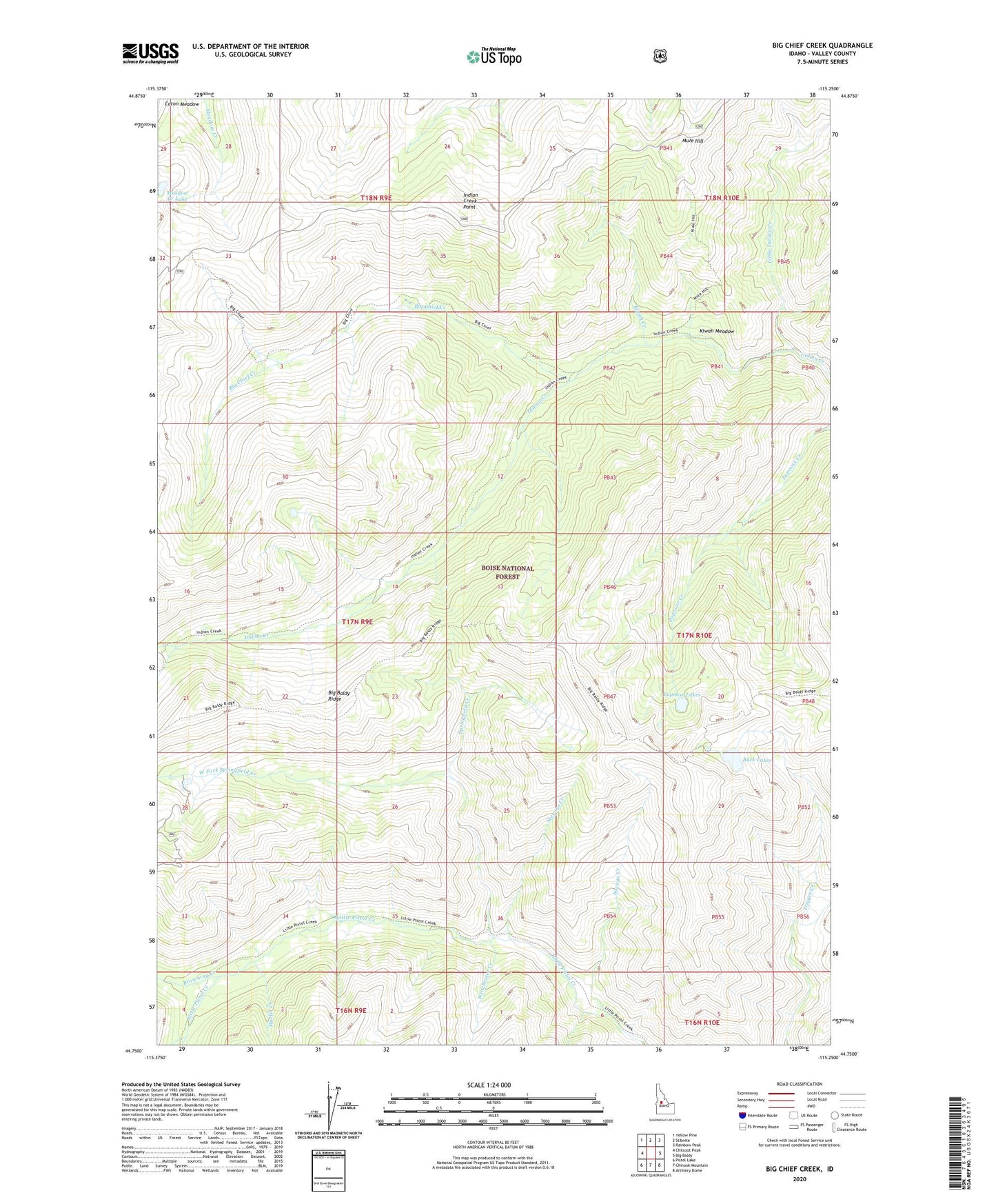
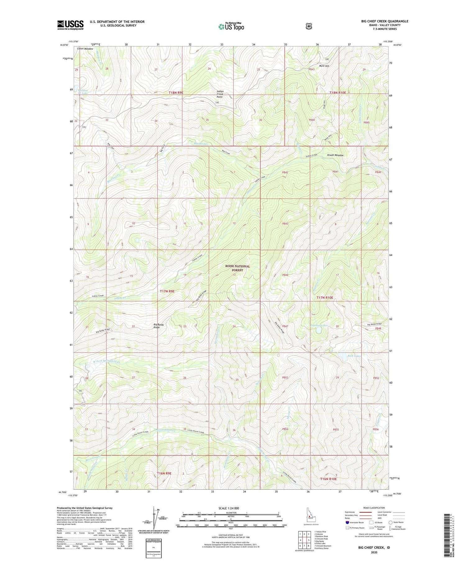
Big Chief Creek Idaho US Topo Map
Couldn't load pickup availability
Also explore the Big Chief Creek Forest Service Topo of this same quad for updated USFS data
2024 topographic map quadrangle Big Chief Creek in the state of Idaho. Scale: 1:24000. Based on the newly updated USGS 7.5' US Topo map series, this map is in the following counties: Valley. The map contains contour data, water features, and other items you are used to seeing on USGS maps, but also has updated roads and other features. This is the next generation of topographic maps. Printed on high-quality waterproof paper with UV fade-resistant inks.
Quads adjacent to this one:
West: Chilcoot Peak
Northwest: Yellow Pine
North: Stibnite
Northeast: Rainbow Peak
East: Big Baldy
Southeast: Artillery Dome
South: Chinook Mountain
Southwest: Pistol Lake
This map covers the same area as the classic USGS quad with code o44115g3.
Contains the following named places: Big Chief Creek, Big Chief Creek Trail, Browning Creek, Buck Lake, Buck Lakes, Garand Creek, Indian Creek Point, Kiwah Creek, Kiwah Meadow, Little Indian Creek, Marlin Creek, Meadow Creek Lake, Mule Hill, Mule Hill Trail, Papoose Lakes, Savage Creek, Springfield Creek, Springfield Mine, Stevens Creek, Stibnite Division, West Fork Springfield Creek, Winchester Creek