MyTopo
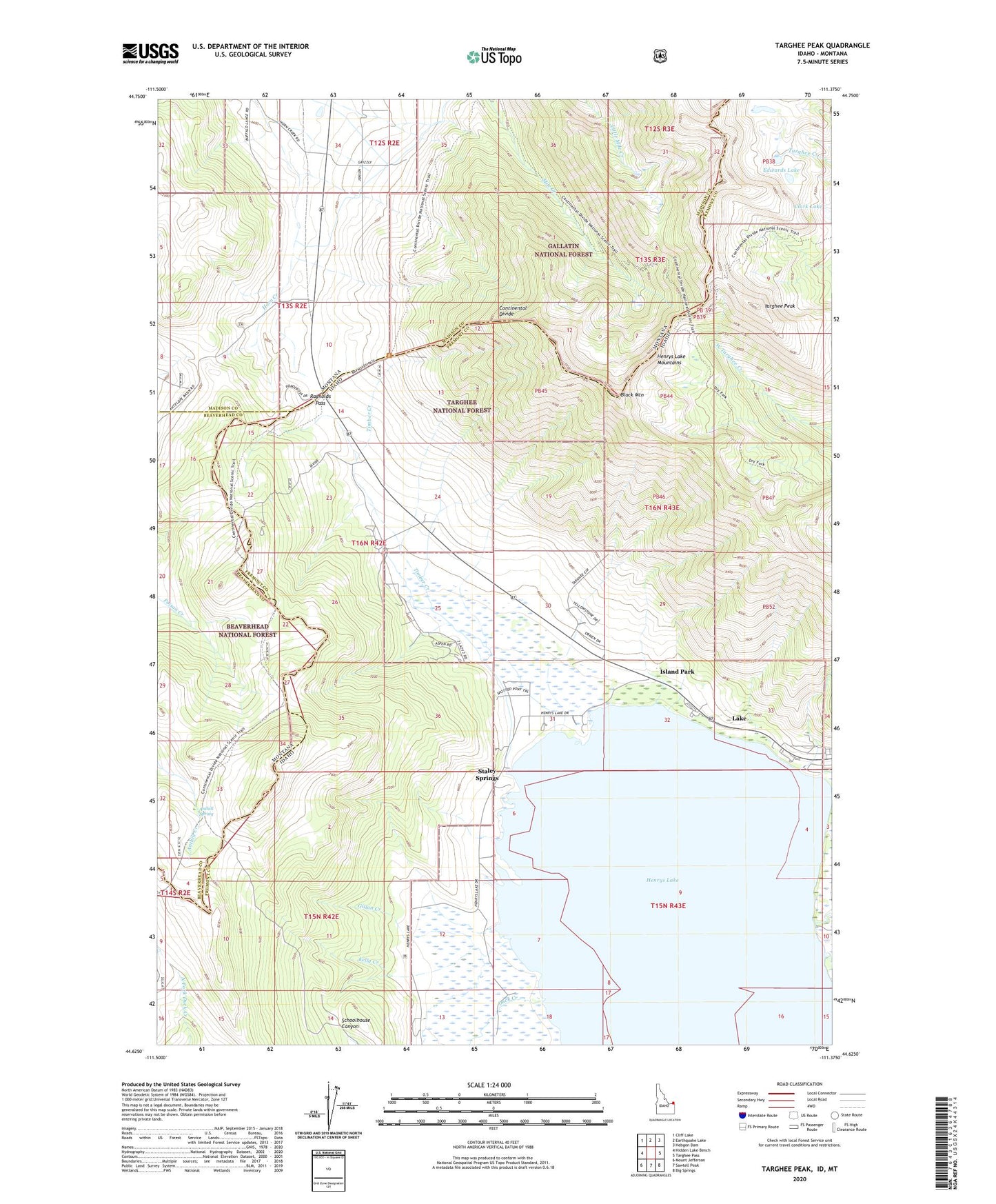
Targhee Peak Idaho US Topo Map
Couldn't load pickup availability
Also explore the Targhee Peak Forest Service Topo of this same quad for updated USFS data
2024 topographic map quadrangle Targhee Peak in the states of Idaho, Montana. Scale: 1:24000. Based on the newly updated USGS 7.5' US Topo map series, this map is in the following counties: Fremont, Madison, Beaverhead, Gallatin. The map contains contour data, water features, and other items you are used to seeing on USGS maps, but also has updated roads and other features. This is the next generation of topographic maps. Printed on high-quality waterproof paper with UV fade-resistant inks.
Quads adjacent to this one:
West: Hidden Lake Bench
Northwest: Cliff Lake
North: Earthquake Lake
Northeast: Hebgen Dam
East: Targhee Pass
Southeast: Big Springs
South: Sawtell Peak
Southwest: Mount Jefferson
Contains the following named places: 12S02E34DAD_01 Well, Anthill Spring, Black Mountain, Clark Lake, Duck Creek, Edwards Lake, Gillan Creek, Henrys Lake, Henrys Lake Fish Hatchery, Johnson Ranch, Kelly Creek, Lake, Raynolds Pass, Staley Springs, Targhee Creek, Targhee Peak, Timber Creek, Webster Ranch, Wild Rose Ranch