MyTopo
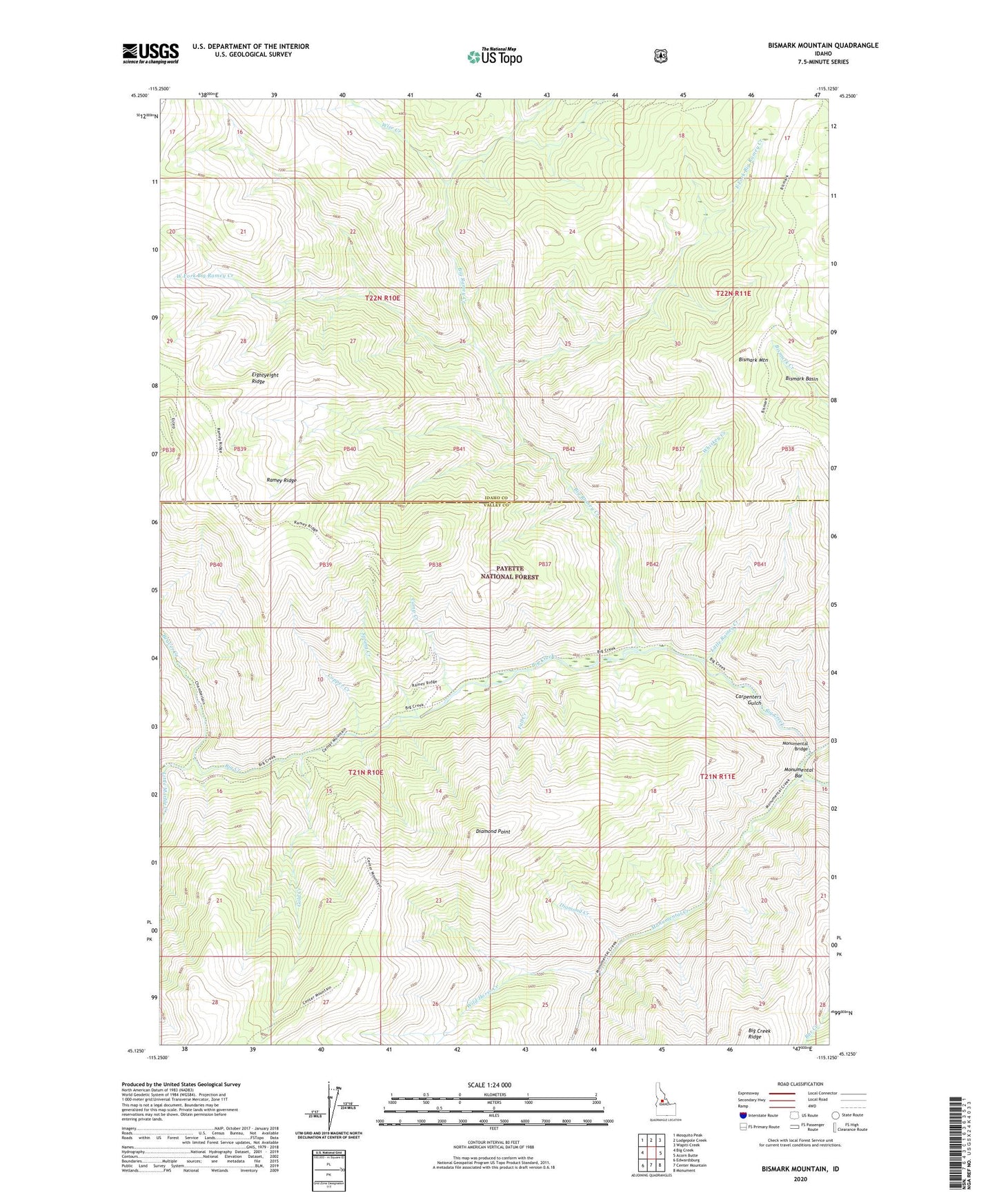
Bismark Mountain Idaho US Topo Map
Couldn't load pickup availability
Also explore the Bismark Mountain Forest Service Topo of this same quad for updated USFS data
2024 topographic map quadrangle Bismark Mountain in the state of Idaho. Scale: 1:24000. Based on the newly updated USGS 7.5' US Topo map series, this map is in the following counties: Idaho, Valley. The map contains contour data, water features, and other items you are used to seeing on USGS maps, but also has updated roads and other features. This is the next generation of topographic maps. Printed on high-quality waterproof paper with UV fade-resistant inks.
Quads adjacent to this one:
West: Big Creek
Northwest: Mosquito Peak
North: Lodgepole Creek
Northeast: Wapiti Creek
East: Acorn Butte
Southeast: Monument
South: Center Mountain
Southwest: Edwardsburg
This map covers the same area as the classic USGS quad with code o45115b2.
Contains the following named places: Beaver Creek, Big Ramey Creek, Bismark Mountain, Bismark Trail, Camp Creek, Carpenters Gulch, Center Mountain Trail, Copper Camp, Copper Creek, Crooked Creek, Diamond Creek, Diamond Point, East Fork Big Ramey Creek, Eightyeight Ridge, Fall Creek, Gold Creek, Little Marble Creek, Little Ramey Creek, Monumental Bar, Monumental Bridge, Monumental Creek, Spring Creek, West Fork Big Ramey Creek, Whiskey Creek, Wild Horse Creek, Wise Creek