MyTopo
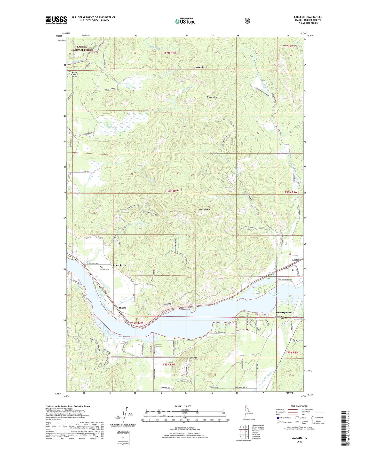
Laclede Idaho US Topo Map
Couldn't load pickup availability
Also explore the Laclede Forest Service Topo of this same quad for updated USFS data
2024 topographic map quadrangle Laclede in the state of Idaho. Scale: 1:24000. Based on the newly updated USGS 7.5' US Topo map series, this map is in the following counties: Bonner. The map contains contour data, water features, and other items you are used to seeing on USGS maps, but also has updated roads and other features. This is the next generation of topographic maps. Printed on high-quality waterproof paper with UV fade-resistant inks.
Quads adjacent to this one:
West: Priest River
Northwest: Quartz Mountain
North: Prater Mountain
Northeast: Happy Fork Gap
East: Morton
Southeast: Careywood
South: Edgemere
Southwest: Blanchard
This map covers the same area as the classic USGS quad with code o48116b7.
Contains the following named places: Carey Boat Ramp, Carey Creek Game Management Area, Carey Pits, Crazy Creek, Gold Cup Mountain, Grouse Mountain, Hoodoo Creek, Hoodoo Game Management Area, Hoodoo Valley, Horn Mountain, Laclede, Laclede Boat Ramp, Laclede Census Designated Place, Laclede Post Office, Lindsey Mountain, Manley Creek, Pend Oreille Wildlife Management Area Carey Unit, Riley Creek, Riley Creek Game Management Area, Riley Creek Recreation Area, Riverside, Riverside Post Office, Sagle Fire District Station 4, Sawyer, Selkirk Fire Laclede Station, Seneacquoteen, Seneacquoteen Cemetery, Thama, The Settlement, ZIP Code: 83841