MyTopo
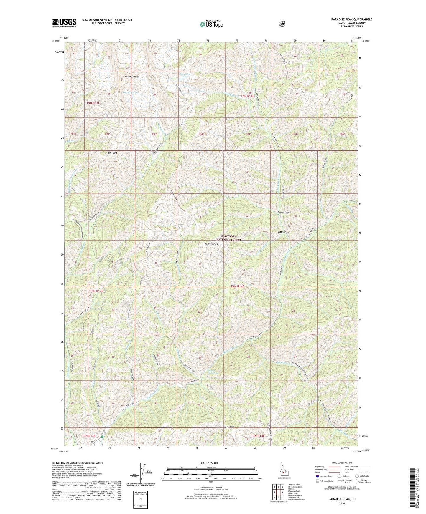
Paradise Peak Idaho US Topo Map
Couldn't load pickup availability
Also explore the Paradise Peak Forest Service Topo of this same quad for updated USFS data
2023 topographic map quadrangle Paradise Peak in the state of Idaho. Scale: 1:24000. Based on the newly updated USGS 7.5' US Topo map series, this map is in the following counties: Camas. The map contains contour data, water features, and other items you are used to seeing on USGS maps, but also has updated roads and other features. This is the next generation of topographic maps. Printed on high-quality waterproof paper with UV fade-resistant inks.
Quads adjacent to this one:
West: Newman Peak
Northwest: Marshall Peak
North: Frenchman Creek
Northeast: Galena
East: Baker Peak
Southeast: Dollarhide Mountain
South: Sydney Butte
Southwest: Boardman Creek
This map covers the same area as the classic USGS quad with code o43114f7.
Contains the following named places: Barlow Creek, Big Peak Creek, Bluff Creek, Calf Creek, Canyon Campground, Elk Point, Little Pinyon, Long Tom Creek, Narrow Creek, North Fork Big Smoky Creek, Paradise Lake, Paradise Peak, Pinyon Gulch, Poison Creek, Skillern Creek, Skillern Hot Springs, Skillern Peak, Snowslide Creek, Snowslide Lakes