MyTopo
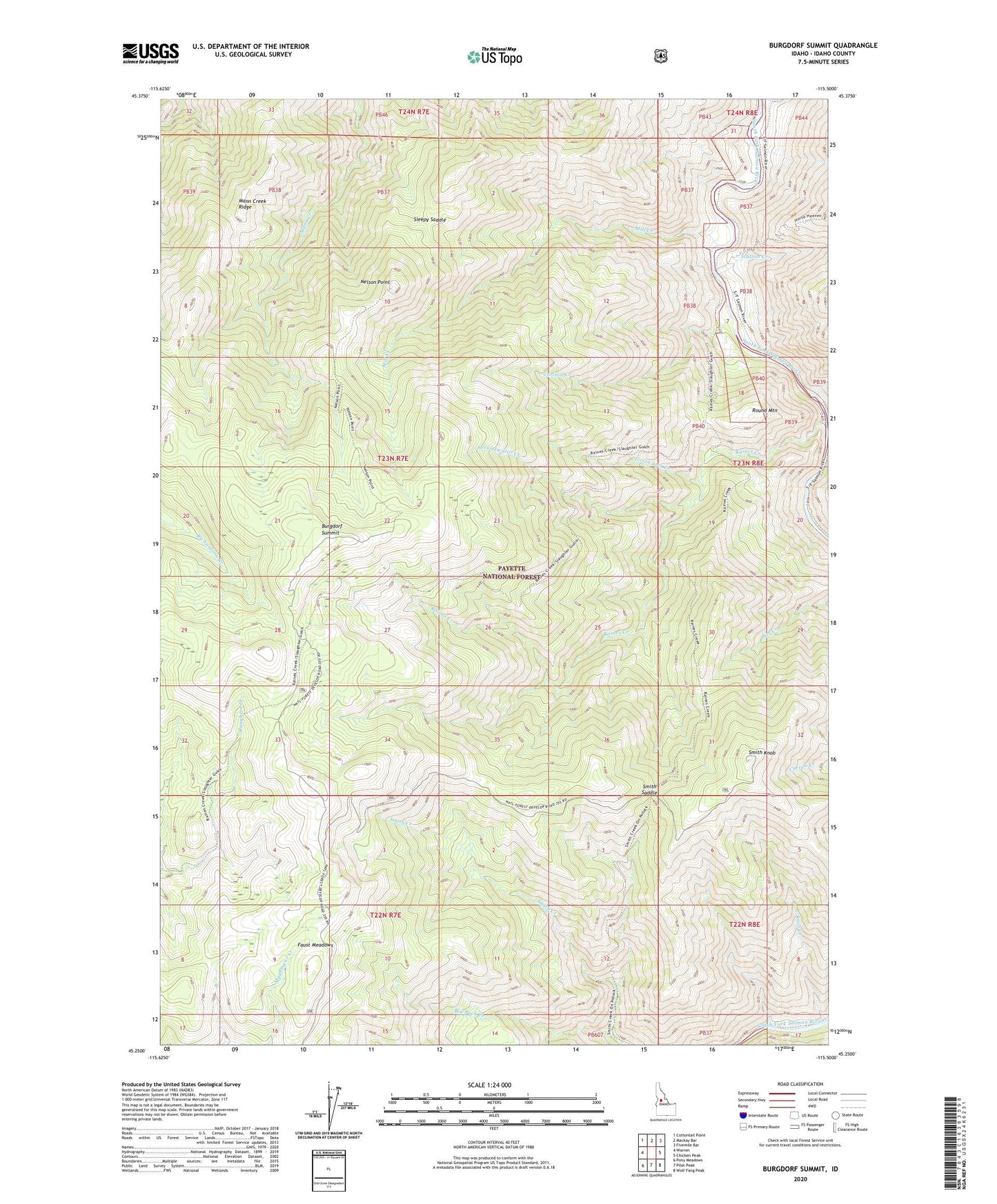
Burgdorf Summit Idaho US Topo Map
Couldn't load pickup availability
Also explore the Burgdorf Summit Forest Service Topo of this same quad for updated USFS data
2024 topographic map quadrangle Burgdorf Summit in the state of Idaho. Scale: 1:24000. Based on the newly updated USGS 7.5' US Topo map series, this map is in the following counties: Idaho. The map contains contour data, water features, and other items you are used to seeing on USGS maps, but also has updated roads and other features. This is the next generation of topographic maps. Printed on high-quality waterproof paper with UV fade-resistant inks.
Quads adjacent to this one:
West: Warren
Northwest: Cottontail Point
North: Mackay Bar
Northeast: Fivemile Bar
East: Chicken Peak
Southeast: Wolf Fang Peak
South: Pilot Peak
Southwest: Pony Meadows
This map covers the same area as the classic USGS quad with code o45115c5.
Contains the following named places: Badley Ranch, Big Buck Creek, Burgdorf Summit, Carlson Creek, Faust Meadows, Firstwater Creek, Little Buck Creek, Mann Creek Ridge, Mill Creek, Mill Lookout, Nelson Point, Raines Creek Trailhead, Round Mountain, Secondwater Creek, Sleepy Saddle, Smith Knob, Smith Knob Lookout, Smith Saddle, Smith Saddle Trailhead, Station Creek