MyTopo
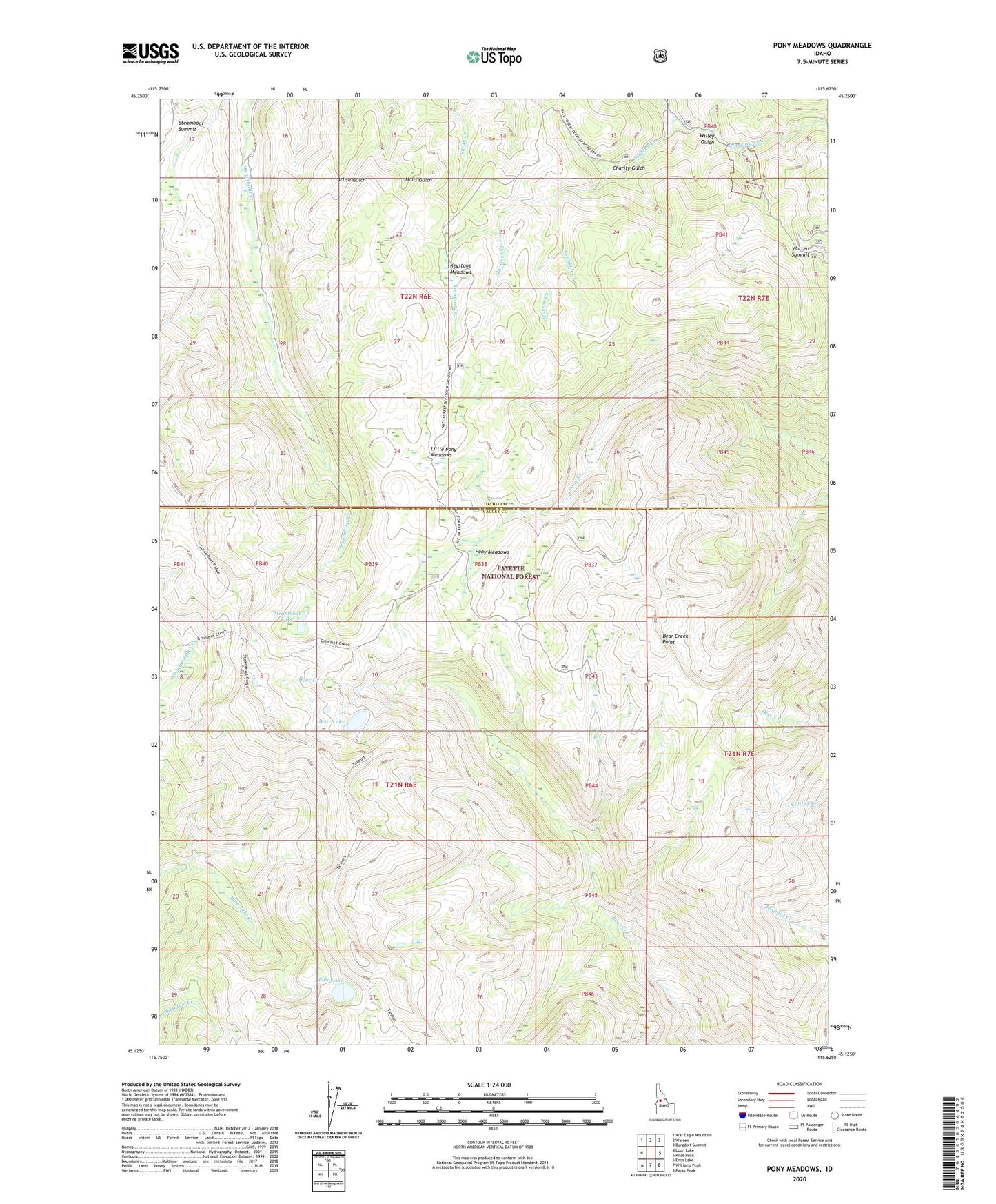
Pony Meadows Idaho US Topo Map
Couldn't load pickup availability
Also explore the Pony Meadows Forest Service Topo of this same quad for updated USFS data
2024 topographic map quadrangle Pony Meadows in the state of Idaho. Scale: 1:24000. Based on the newly updated USGS 7.5' US Topo map series, this map is in the following counties: Valley, Idaho. The map contains contour data, water features, and other items you are used to seeing on USGS maps, but also has updated roads and other features. This is the next generation of topographic maps. Printed on high-quality waterproof paper with UV fade-resistant inks.
Quads adjacent to this one:
West: Loon Lake
Northwest: War Eagle Mountain
North: Warren
Northeast: Burgdorf Summit
East: Pilot Peak
Southeast: Parks Peak
South: Williams Peak
Southwest: Enos Lake
This map covers the same area as the classic USGS quad with code o45115b6.
Contains the following named places: Bear Creek Point, Bear Lake, Blue Lake, Charity Gulch, Franklin Creek, Keystone Meadows, Little Pony Meadows, Martinez Creek, Mayflower Creek, Pony Meadows, Steamboat Lake, Steamboat Summit, Warren Summit, Webfoot Creek, Willey Gulch