MyTopo
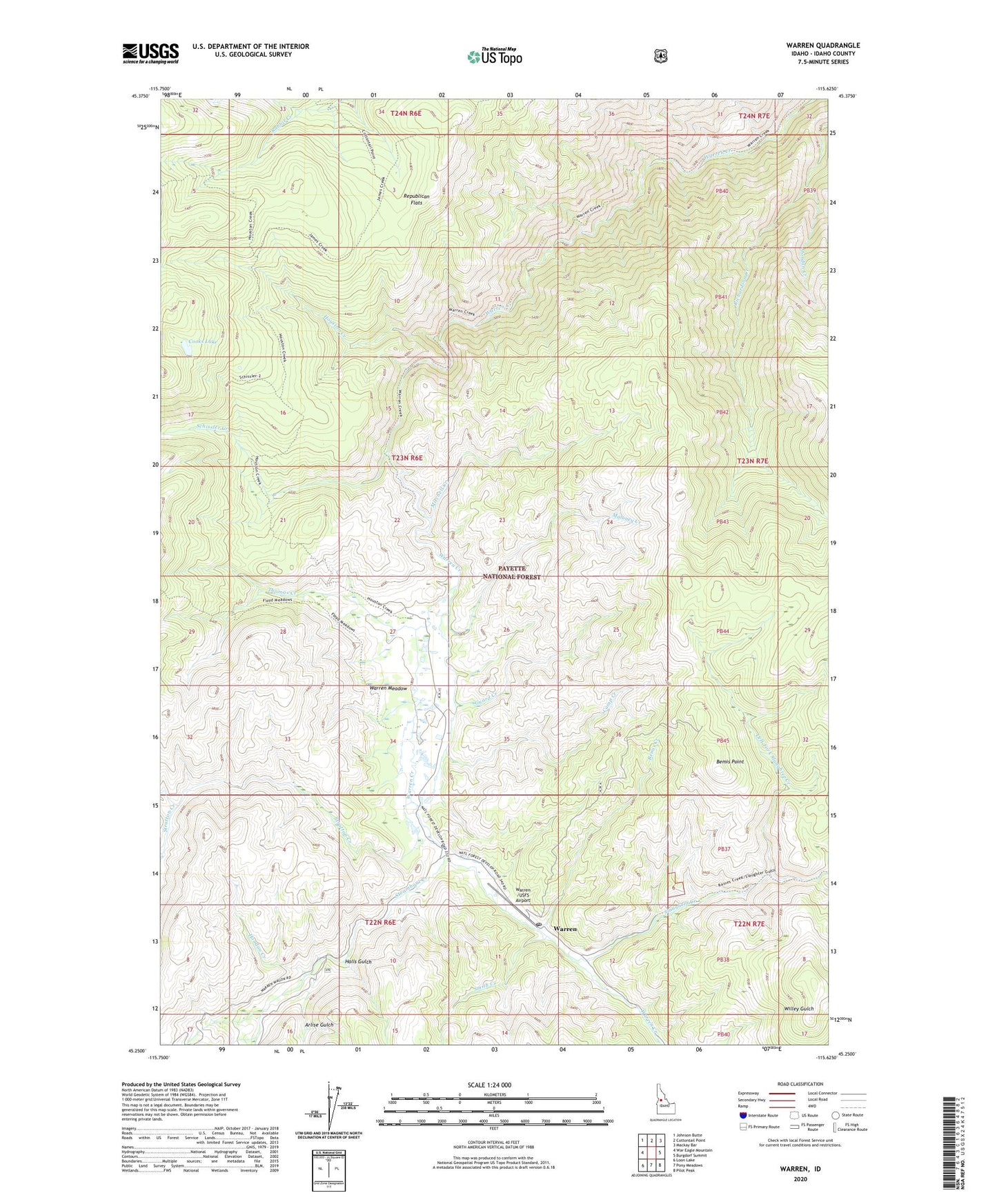
Warren Idaho US Topo Map
Couldn't load pickup availability
Also explore the Warren Forest Service Topo of this same quad for updated USFS data
2024 topographic map quadrangle Warren in the state of Idaho. Scale: 1:24000. Based on the newly updated USGS 7.5' US Topo map series, this map is in the following counties: Idaho. The map contains contour data, water features, and other items you are used to seeing on USGS maps, but also has updated roads and other features. This is the next generation of topographic maps. Printed on high-quality waterproof paper with UV fade-resistant inks.
Quads adjacent to this one:
West: War Eagle Mountain
Northwest: Johnson Butte
North: Cottontail Point
Northeast: Mackay Bar
East: Burgdorf Summit
Southeast: Pilot Peak
South: Pony Meadows
Southwest: Loon Lake
This map covers the same area as the classic USGS quad with code o45115c6.
Contains the following named places: Arlise Gulch, Bemis Creek, Bemis Point, Camp Creek, Cooks Lake, Guard Creek, Halls Gulch, Hoodoo Creek, Houston Creek, Jordan Creek, Left Fork Slaughter Creek, Maloney Creek, Mitchell Creek, Republican Flats, Rescue Mine, Schissler Creek, Slaughter Creek, Smith Creek, Steamboat Creek, Stratton Creek, Thomas Creek, Unity Mine, Warren, Warren /USFS Airport, Warren Forest Service Facility, Warren Meadow, Warren Post Office, West Fork Stratton Creek