
MyTopo
Chesterfield Idaho US Topo Map
Couldn't load pickup availability
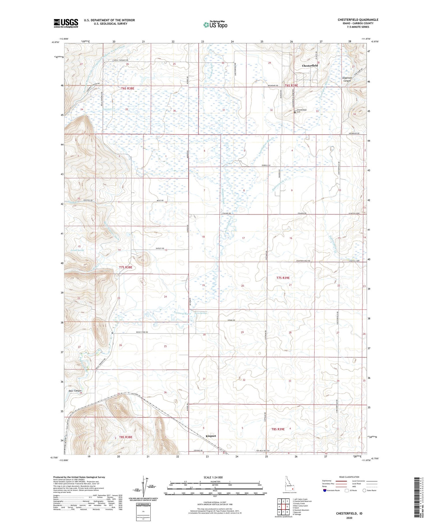
2023 topographic map quadrangle Chesterfield in the state of Idaho. Scale: 1:24000. Based on the newly updated USGS 7.5' US Topo map series, this map is in the following counties: Caribou. The map contains contour data, water features, and other items you are used to seeing on USGS maps, but also has updated roads and other features. This is the next generation of topographic maps. Printed on high-quality waterproof paper with UV fade-resistant inks.
Quads adjacent to this one:
West: Bear Camp Gulch
Northwest: Jeff Cabin Creek
North: Chesterfield Reservoir
Northeast: Grizzly Creek
East: Hatch
Southeast: Talmage
South: Bancroft
Southwest: Haystack Mountain
This map covers the same area as the classic USGS quad with code o42111g8.
Contains the following named places: Bancroft Division, Chesterfield, Chesterfield Cemetery, Chesterfield Church, Chesterfield Meeting House, Deer Canyon, Downey Canal, Eighteenmile Creek, Gooch School, Grim Springs, Higginson Canyon, Kelly School, Kelly Toponce Ditch, King Creek, Kinport, Moses Creek, North Canyon School, Orman Spring, Portneuf Marsh Valley Irrigation Company Feeder Canal, Rigby School, Smith Creek, Toponce and Chesterfield Land Co Ditch, Toponce Creek, Twentyfour Mile Creek, ZIP Code: 83217


