MyTopo
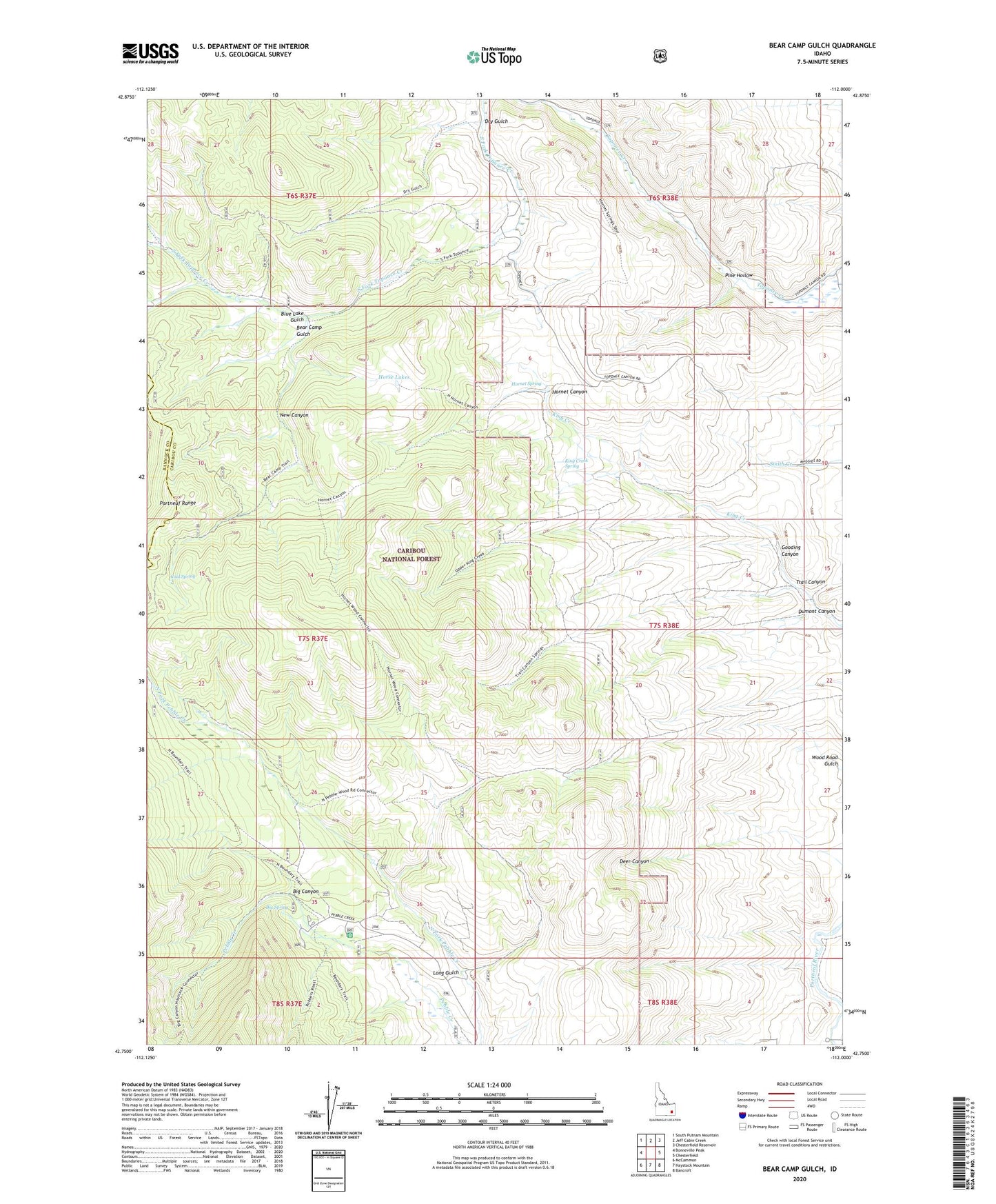
Bear Camp Gulch Idaho US Topo Map
Couldn't load pickup availability
Also explore the Bear Camp Gulch Forest Service Topo of this same quad for updated USFS data
2023 topographic map quadrangle Bear Camp Gulch in the state of Idaho. Scale: 1:24000. Based on the newly updated USGS 7.5' US Topo map series, this map is in the following counties: Caribou, Bannock. The map contains contour data, water features, and other items you are used to seeing on USGS maps, but also has updated roads and other features. This is the next generation of topographic maps. Printed on high-quality waterproof paper with UV fade-resistant inks.
Quads adjacent to this one:
West: Bonneville Peak
Northwest: South Putnam Mountain
North: Jeff Cabin Creek
Northeast: Chesterfield Reservoir
East: Chesterfield
Southeast: Bancroft
South: Haystack Mountain
Southwest: McCammon
This map covers the same area as the classic USGS quad with code o42112g1.
Contains the following named places: Bear Camp, Bear Camp Gulch, Big Canyon, Big Spring, Big Spring Campground, Blue Lake Gulch, Cold Spring, Dry Gulch, Dumont Canyon, Gooding Canyon, Hornet Canyon, Hornet Spring, Horse Lakes, King Creek Spring, Long Gulch, New Canyon, Pebble Cow Camp, Pebble Guard Station, Pine Hollow, Trail Canyon, Wood Road Gulch