MyTopo
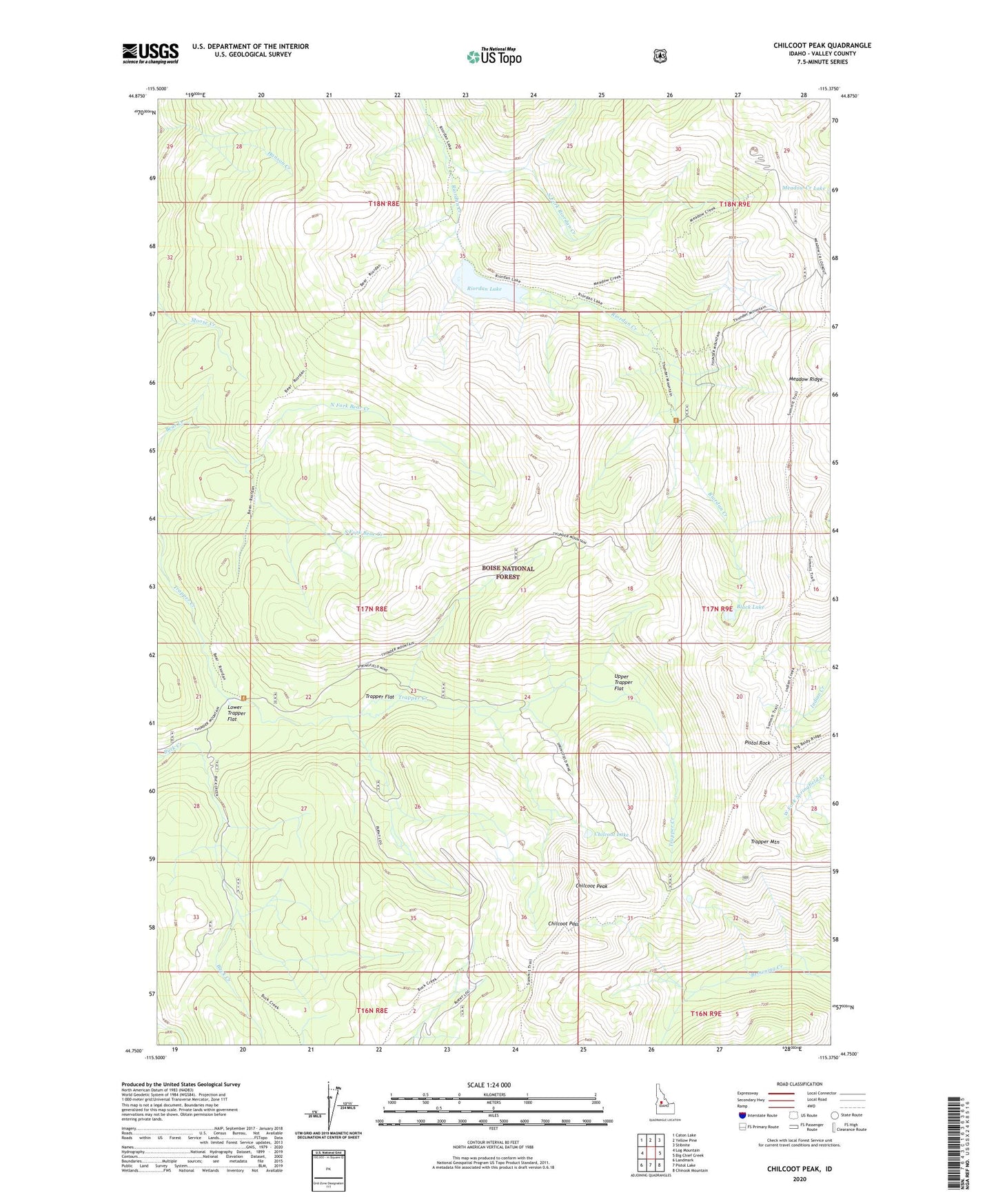
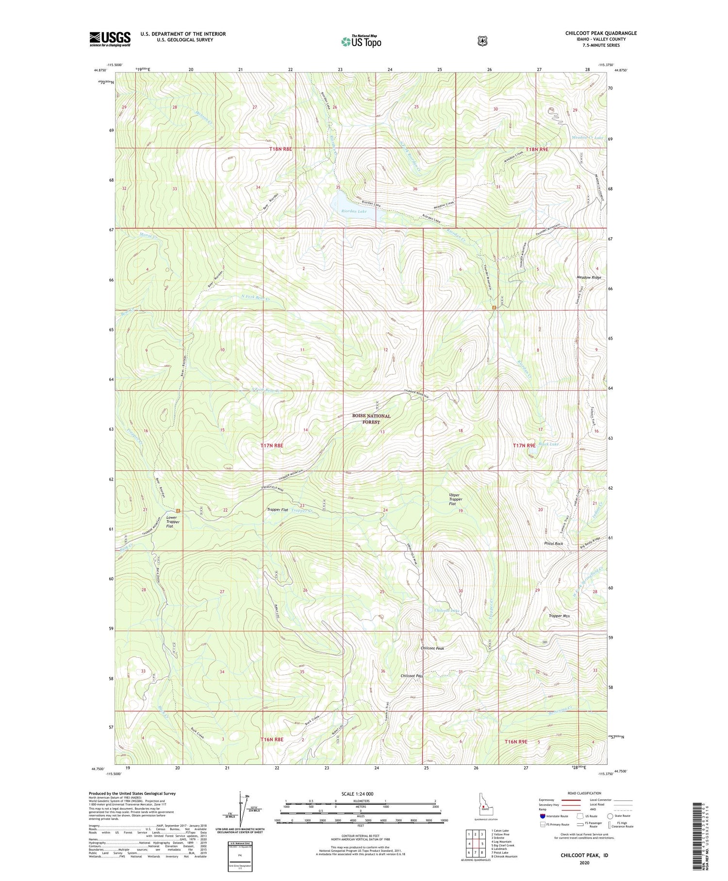
Chilcoot Peak Idaho US Topo Map
Couldn't load pickup availability
Also explore the Chilcoot Peak Forest Service Topo of this same quad for updated USFS data
2024 topographic map quadrangle Chilcoot Peak in the state of Idaho. Scale: 1:24000. Based on the newly updated USGS 7.5' US Topo map series, this map is in the following counties: Valley. The map contains contour data, water features, and other items you are used to seeing on USGS maps, but also has updated roads and other features. This is the next generation of topographic maps. Printed on high-quality waterproof paper with UV fade-resistant inks.
Quads adjacent to this one:
West: Log Mountain
Northwest: Caton Lake
North: Yellow Pine
Northeast: Stibnite
East: Big Chief Creek
Southeast: Chinook Mountain
South: Pistol Lake
Southwest: Landmark
This map covers the same area as the classic USGS quad with code o44115g4.
Contains the following named places: Black Lake, Chilcoot Lake, Chilcoot Pass, Chilcoot Peak, Indian Creek Trail, Lower Trapper Flat, Meadow Creek Lookout, Meadow Ridge, North Fork Bear Creek, North Fork Riordan Creek, Pistol Rock, Riordan Lake, South Fork Bear Creek, Trapper Flat, Trapper Mountain, Upper Trapper Flat