MyTopo
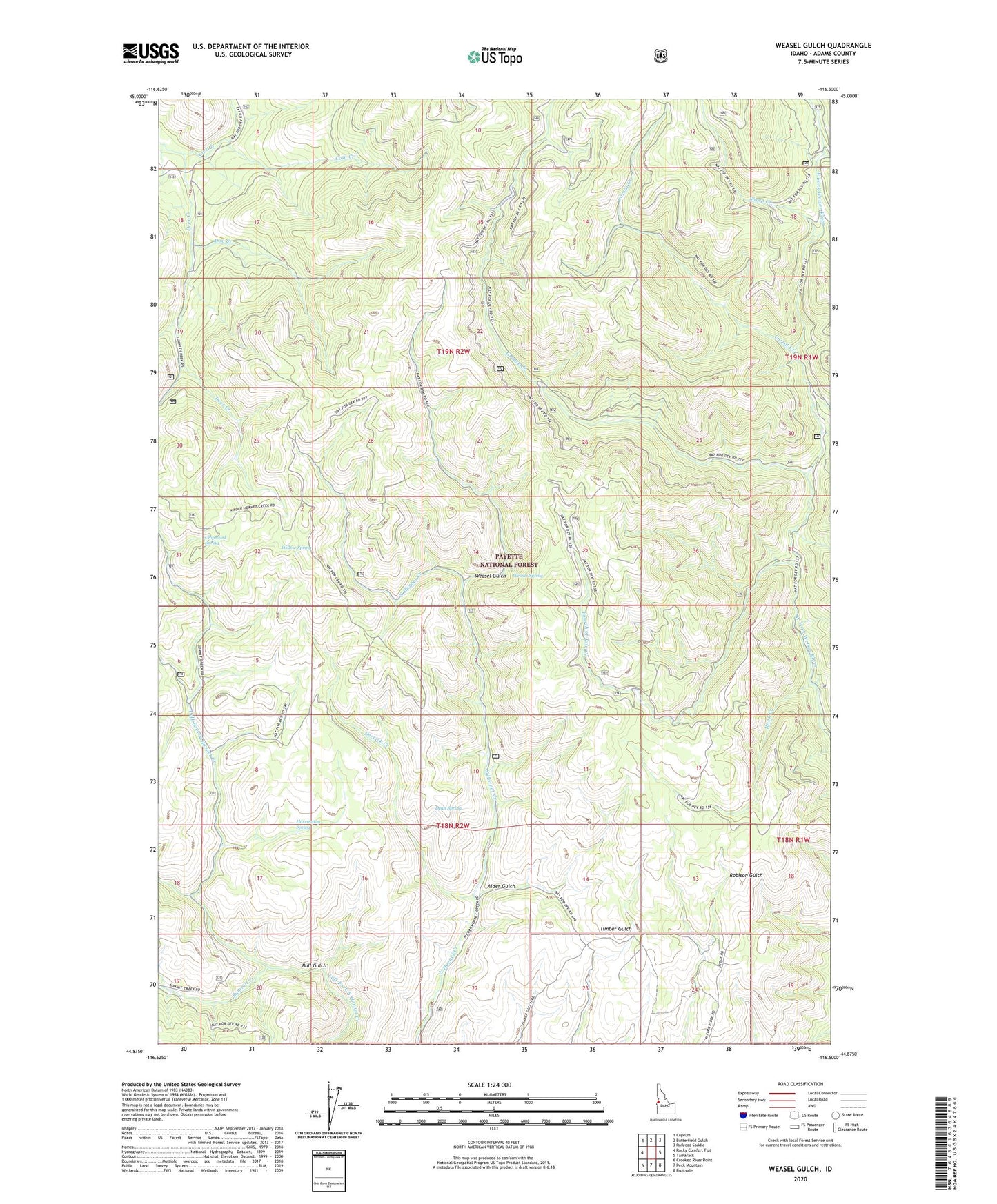
Weasel Gulch Idaho US Topo Map
Couldn't load pickup availability
Also explore the Weasel Gulch Forest Service Topo of this same quad for updated USFS data
2024 topographic map quadrangle Weasel Gulch in the state of Idaho. Scale: 1:24000. Based on the newly updated USGS 7.5' US Topo map series, this map is in the following counties: Adams. The map contains contour data, water features, and other items you are used to seeing on USGS maps, but also has updated roads and other features. This is the next generation of topographic maps. Printed on high-quality waterproof paper with UV fade-resistant inks.
Quads adjacent to this one:
West: Rocky Comfort Flat
Northwest: Cuprum
North: Butterfield Gulch
Northeast: Railroad Saddle
East: Tamarack
Southeast: Fruitvale
South: Peck Mountain
Southwest: Crooked River Point
This map covers the same area as the classic USGS quad with code o44116h5.
Contains the following named places: Alder Gulch, Bull Gulch, Chipmunk Spring, Corral Creek, Cottonwood Creek, Cow Creek, Dean Spring, Deer Creek, Derrick Creek, Doe Creek, Fourth of July Creek, Grouse Creek, Harrington Spring, Rock Creek, Sheep Creek, Summit Creek, Weasel Gulch, Weasel Spring, Willow Spring, ZIP Code: 83612