MyTopo
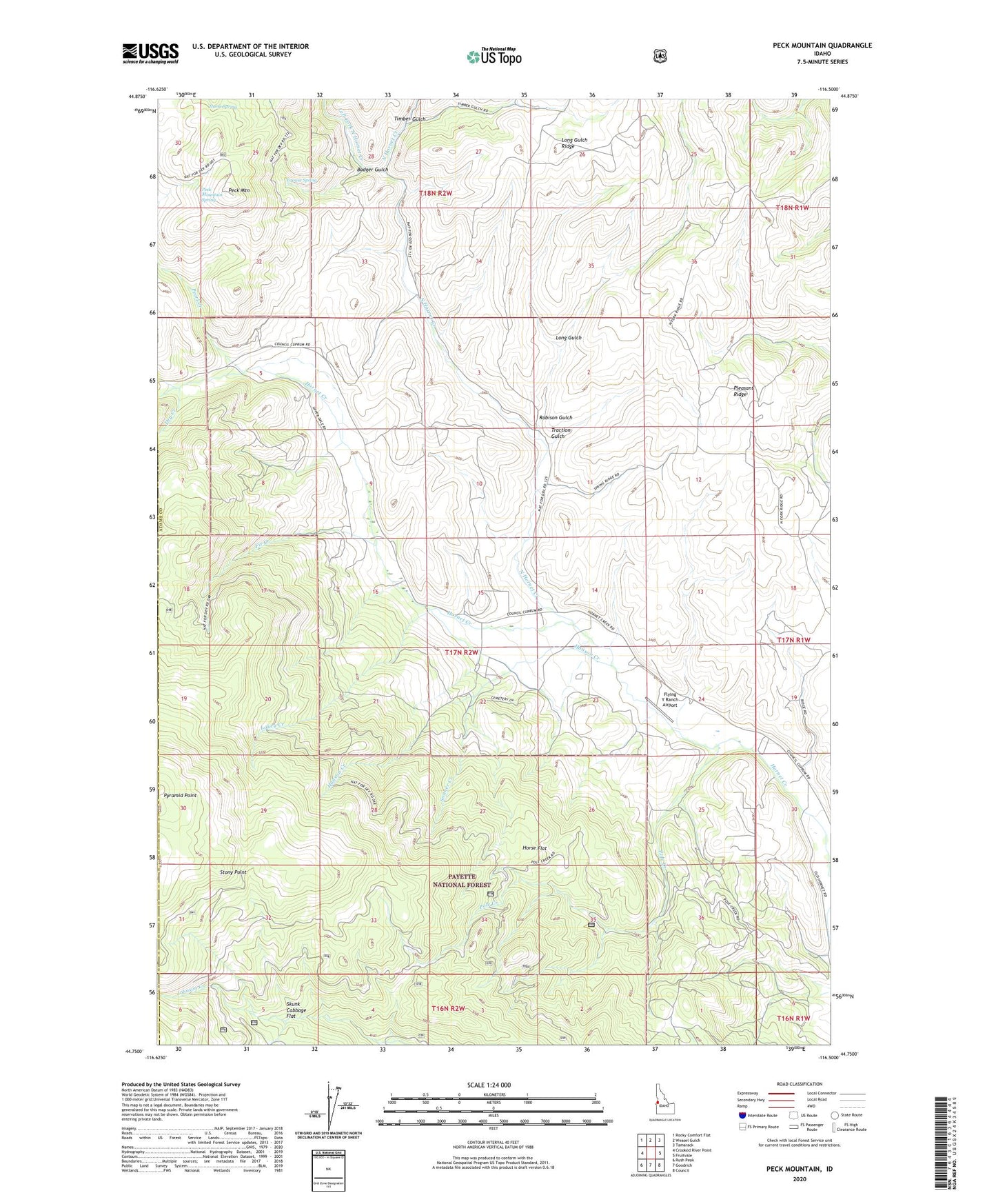
Peck Mountain Idaho US Topo Map
Couldn't load pickup availability
Also explore the Peck Mountain Forest Service Topo of this same quad for updated USFS data
2024 topographic map quadrangle Peck Mountain in the state of Idaho. Scale: 1:24000. Based on the newly updated USGS 7.5' US Topo map series, this map is in the following counties: Adams, Washington. The map contains contour data, water features, and other items you are used to seeing on USGS maps, but also has updated roads and other features. This is the next generation of topographic maps. Printed on high-quality waterproof paper with UV fade-resistant inks.
Quads adjacent to this one:
West: Crooked River Point
Northwest: Rocky Comfort Flat
North: Weasel Gulch
Northeast: Tamarack
East: Fruitvale
Southeast: Council
South: Goodrich
Southwest: Rush Peak
This map covers the same area as the classic USGS quad with code o44116g5.
Contains the following named places: Badger Gulch, Council Division, Dry Creek, Ellsworth-Middle Dam, Fir Creek, Flying Y Ranch Airport, Grouse Spring, Hanson Creek, Hornet Creek Cemetery, Horse Flat, Horse Spring, Lakey Creek, Left Fork North Hornet Creek, Long Gulch, Long Gulch Ridge, Mill Creek, North Hornet Creek, Pearl Creek, Peck Mountain, Peck Mountain Spring, Pleasant Ridge, Pole Creek, Ridge School, Robison Gulch, Skunk Cabbage Flat, Sonner Creek, Stony Point, Timber Gulch, Traction Gulch, Upper Dale School