MyTopo
Fairylawn Idaho US Topo Map
Couldn't load pickup availability
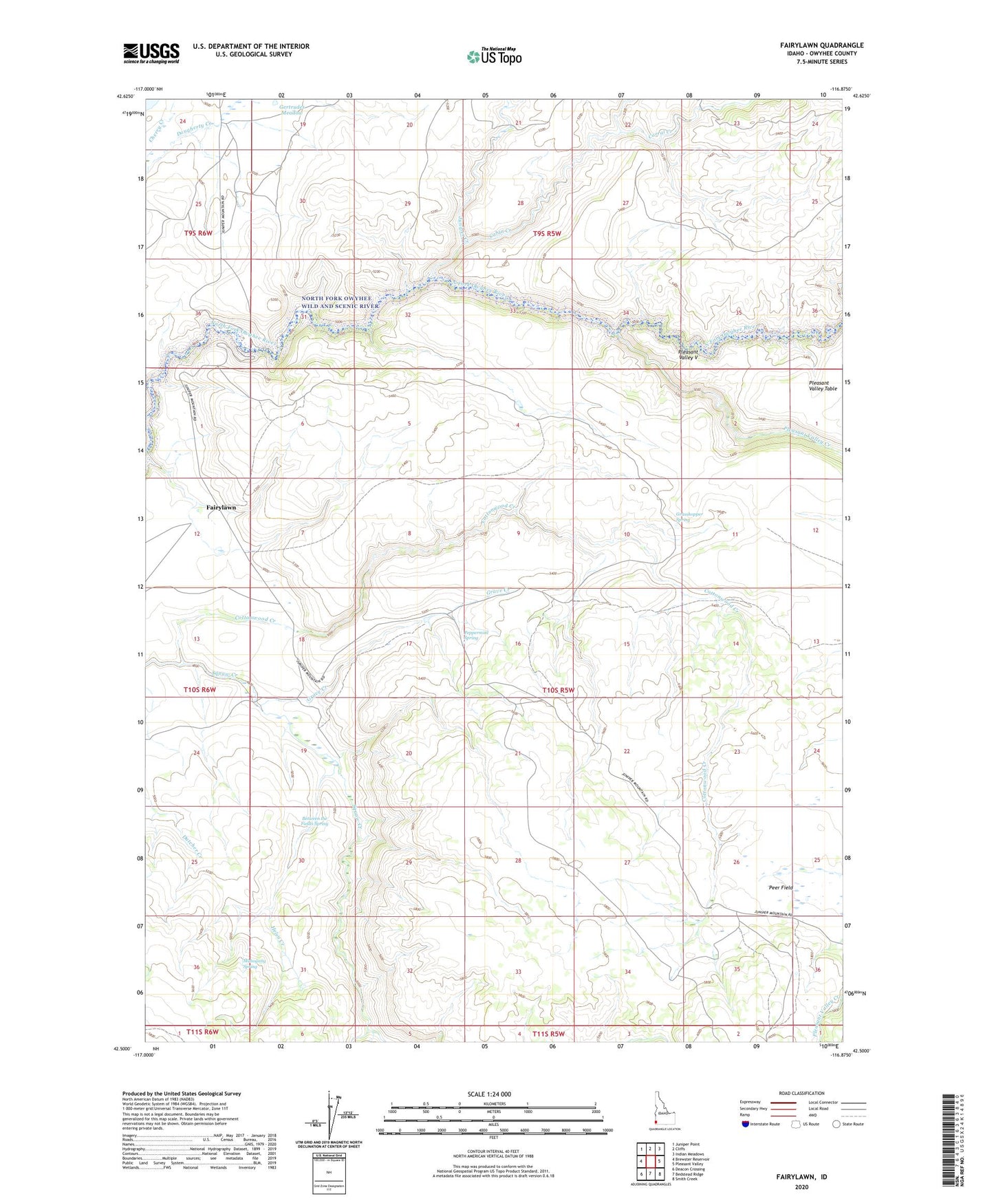
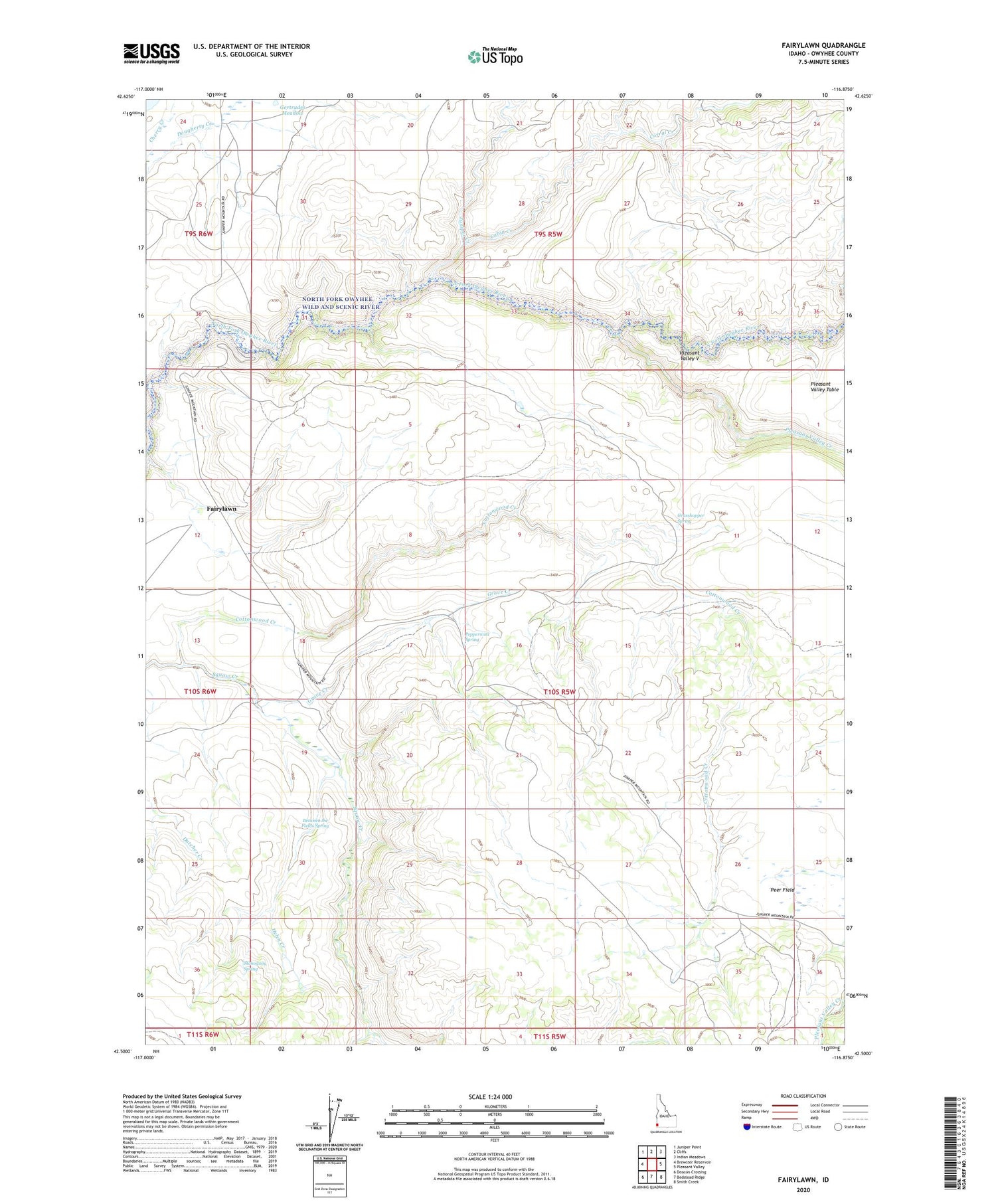
2024 topographic map quadrangle Fairylawn in the state of Idaho. Scale: 1:24000. Based on the newly updated USGS 7.5' US Topo map series, this map is in the following counties: Owyhee. The map contains contour data, water features, and other items you are used to seeing on USGS maps, but also has updated roads and other features. This is the next generation of topographic maps. Printed on high-quality waterproof paper with UV fade-resistant inks.
Quads adjacent to this one:
West: Brewster Reservoir
Northwest: Juniper Point
North: Cliffs
Northeast: Indian Meadows
East: Pleasant Valley
Southeast: Smith Creek
South: Bedstead Ridge
Southwest: Deacon Crossing
This map covers the same area as the classic USGS quad with code o42116e8.
Contains the following named places: Between the Fields Spring, Cabin Creek, Corral Creek, Cottonwood Creek, Fairylawn, Foland Dam, Gertrudes Meadow, Grasshopper Spring, Grave Creek, Hanley Cabin, Helen Creek, Juniper Creek, Juniper Creek Dam, Lowrey Ranch, Mahogany Spring, North Fork Owyhee Wild and Scenic River, Peach Creek, Peer Field, Peppermint Spring, Pleasant Valley Creek, Pleasant Valley V