MyTopo
Cliffs Idaho US Topo Map
Couldn't load pickup availability
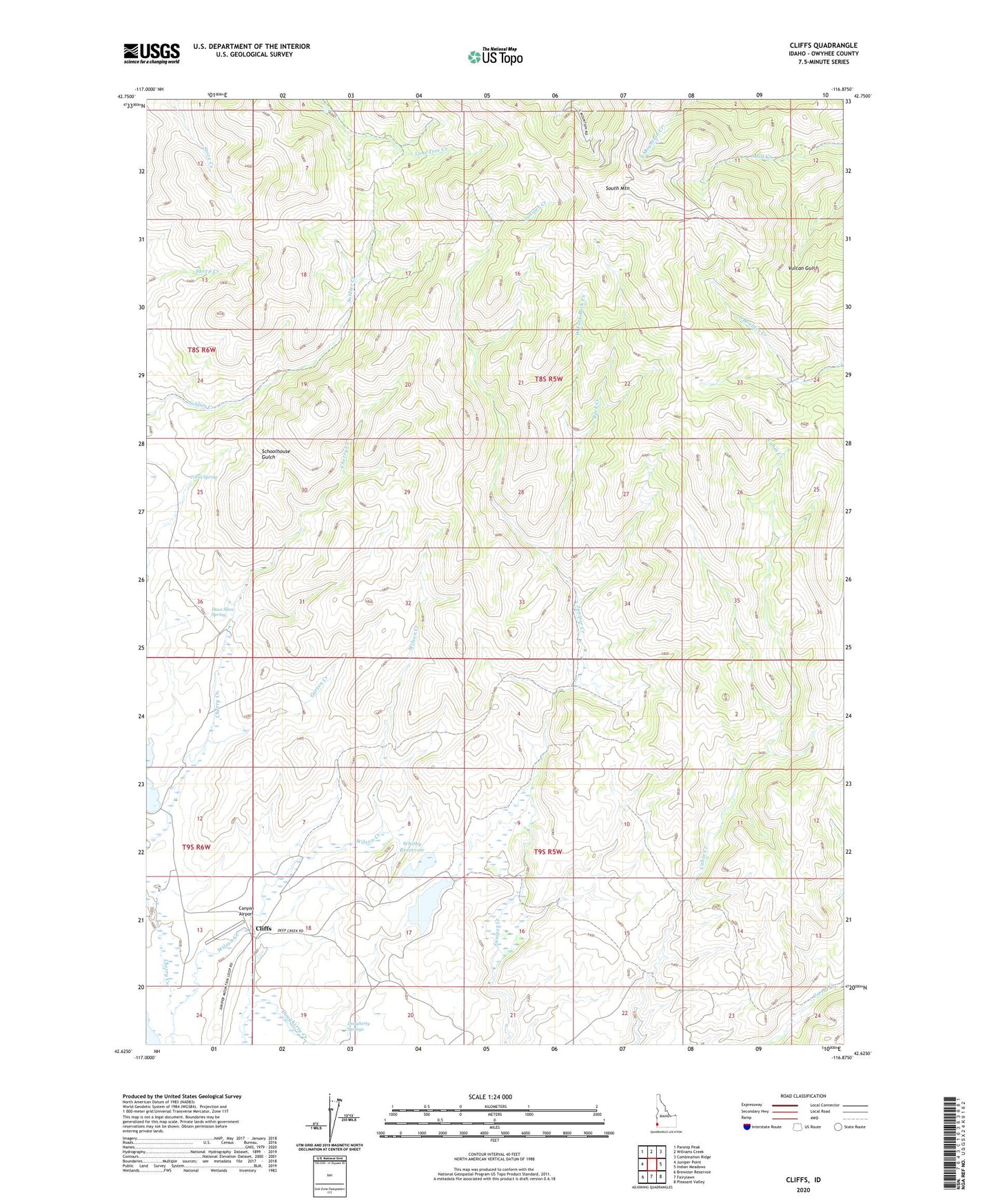
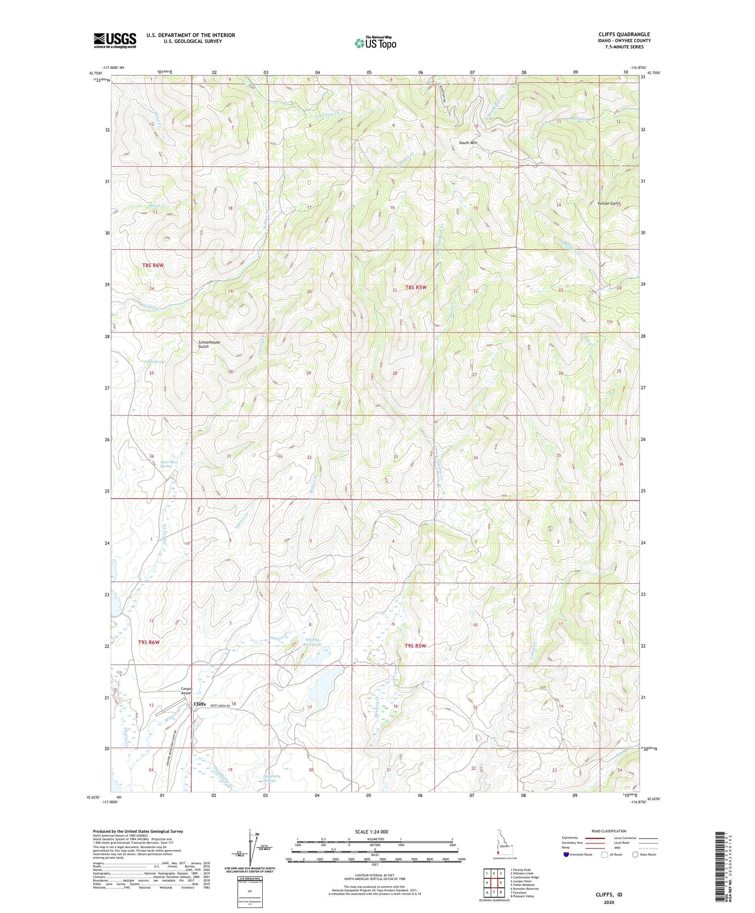
2023 topographic map quadrangle Cliffs in the state of Idaho. Scale: 1:24000. Based on the newly updated USGS 7.5' US Topo map series, this map is in the following counties: Owyhee. The map contains contour data, water features, and other items you are used to seeing on USGS maps, but also has updated roads and other features. This is the next generation of topographic maps. Printed on high-quality waterproof paper with UV fade-resistant inks.
Quads adjacent to this one:
West: Juniper Point
Northwest: Parsnip Peak
North: Williams Creek
Northeast: Combination Ridge
East: Indian Meadows
Southeast: Pleasant Valley
South: Fairylawn
Southwest: Brewster Reservoir
This map covers the same area as the classic USGS quad with code o42116f8.
Contains the following named places: Anderson Reservoir, Buck Creek, Canyon Airport, Cliffs, Cliffs Landing Strip, Corta Spring, Dave Shea Spring, Dougherty Springs, Garten Creek, Golconda Mine, Hardisty and Wilson Dam, Laxey Mine, Sonneman Mine, South Mountain, Standard Mine, Texas Mine, The Post Mine, West Fork Buck Creek, Whitby Reservoir, Wilson Creek