MyTopo
Brewster Reservoir Oregon US Topo Map
Couldn't load pickup availability
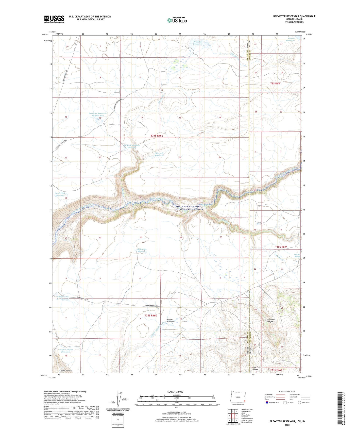
2024 topographic map quadrangle Brewster Reservoir in the states of Oregon, Idaho. Scale: 1:24000. Based on the newly updated USGS 7.5' US Topo map series, this map is in the following counties: Malheur, Owyhee. The map contains contour data, water features, and other items you are used to seeing on USGS maps, but also has updated roads and other features. This is the next generation of topographic maps. Printed on high-quality waterproof paper with UV fade-resistant inks.
Quads adjacent to this one:
West: Three Forks
Northwest: Whitehorse Butte
North: Juniper Point
Northeast: Cliffs
East: Fairylawn
Southeast: Bedstead Ridge
South: Deacon Crossing
Southwest: Drummond Basin
This map covers the same area as the classic USGS quad with code o42117e1.
Contains the following named places: Brewster Ranch, Brewster Reservoir, Brewster Reservoir Number Two, Cherry Creek, Cherry Creek Reservoir, Circle Bar Ranch, Cougar Canyon, Cougar Canyon Reservoir, Dougherty Creek, Dutcher Creek, Dutcher Spring, Little Box Canyon, Little Groundhog Reservoir, Middle Fork Rim Reservoir, Mule Lake Reservoir, North Fork Reservoir, Owyhee Post Office, Soldier Meadows, Squaw Creek, Squaw Creek Vee, Stimmel Dam