MyTopo
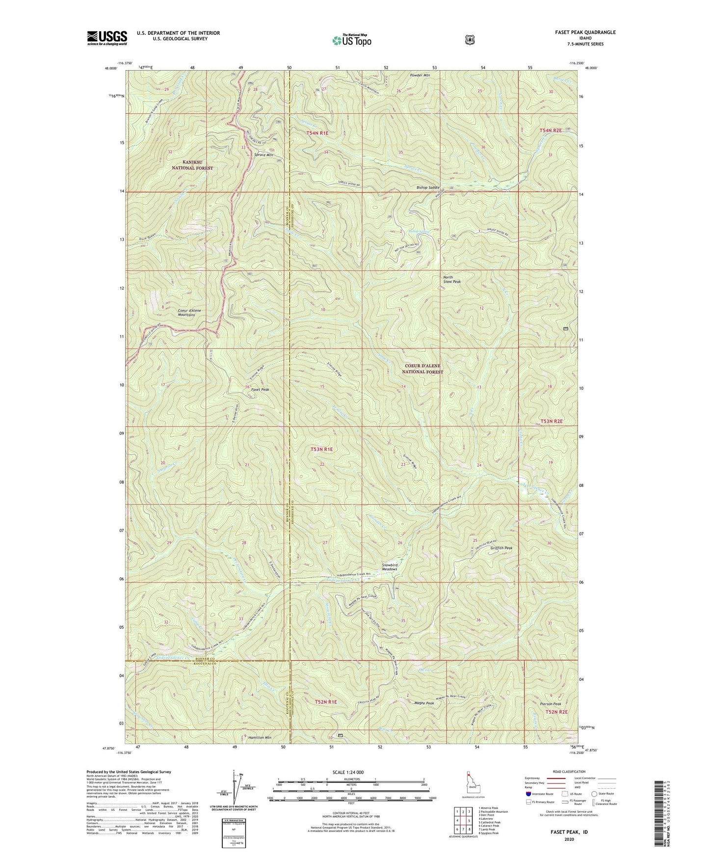
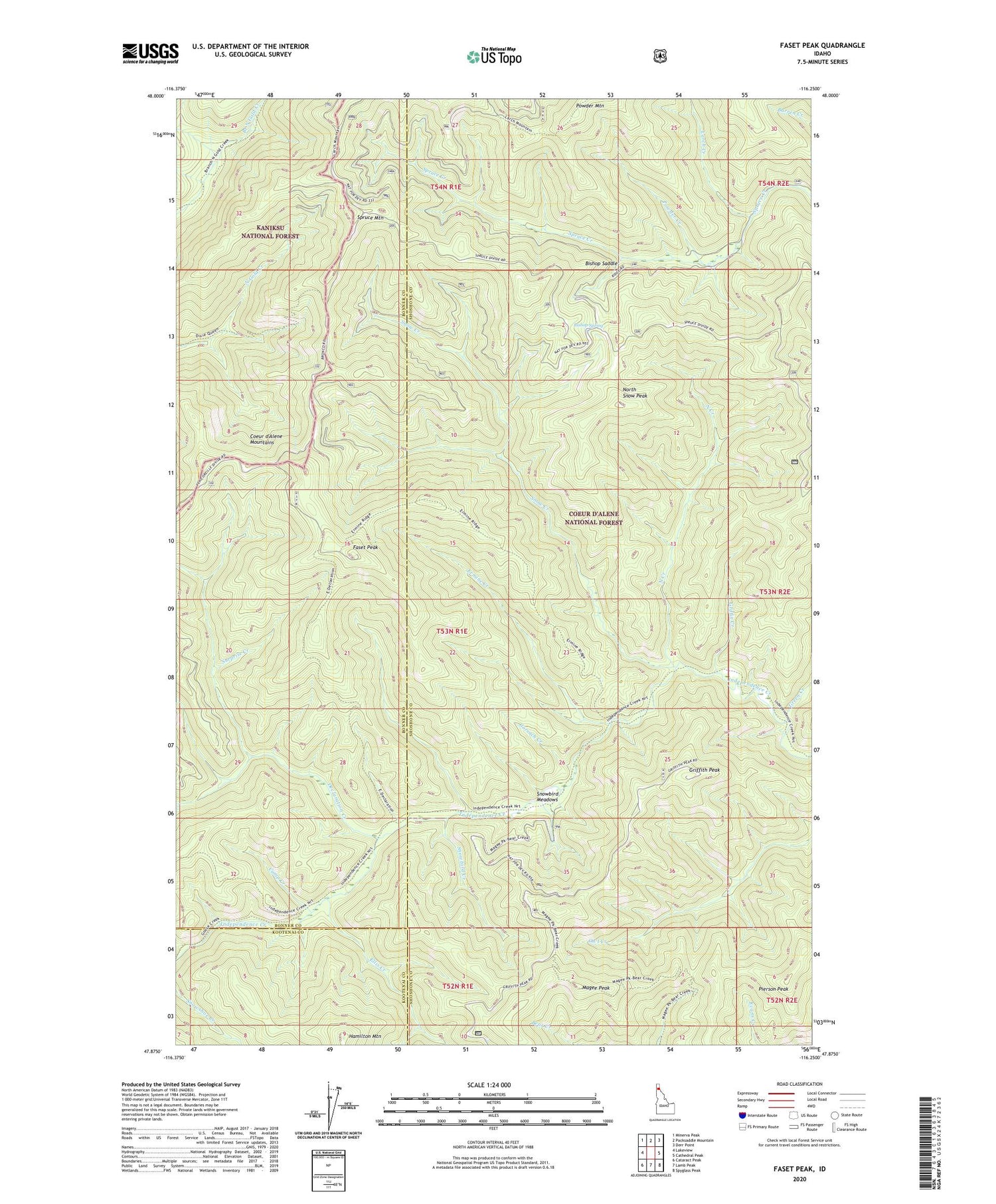
Faset Peak Idaho US Topo Map
Couldn't load pickup availability
Also explore the Faset Peak Forest Service Topo of this same quad for updated USFS data
2024 topographic map quadrangle Faset Peak in the state of Idaho. Scale: 1:24000. Based on the newly updated USGS 7.5' US Topo map series, this map is in the following counties: Shoshone, Bonner, Kootenai. The map contains contour data, water features, and other items you are used to seeing on USGS maps, but also has updated roads and other features. This is the next generation of topographic maps. Printed on high-quality waterproof paper with UV fade-resistant inks.
Quads adjacent to this one:
West: Lakeview
Northwest: Minerva Peak
North: Packsaddle Mountain
Northeast: Derr Point
East: Cathedral Peak
Southeast: Spyglass Peak
South: Lamb Peak
Southwest: Cataract Peak
This map covers the same area as the classic USGS quad with code o47116h3.
Contains the following named places: Bishop Saddle, Bishop Spring, Camp Creek, Declaration Creek, Dixie Queen Mine, Elkhorn, Ellis Creek, Ermine Creek, Ermine Ridge Trail, Faset Peak, Gorsuch Creek, Green Creek, Griffin Creek, Griffith Peak, Hamilton Mountain, Independence Creek National Recreation Trail, Larch Creek, Magee Peak, North Creek, North Snow Peak, Pierson Peak, Powder Creek, Snow Creek, Snowbird Creek, Snowbird Meadows, Spruce Mountain, Surprise Creek, Upper Declaration Trail