MyTopo
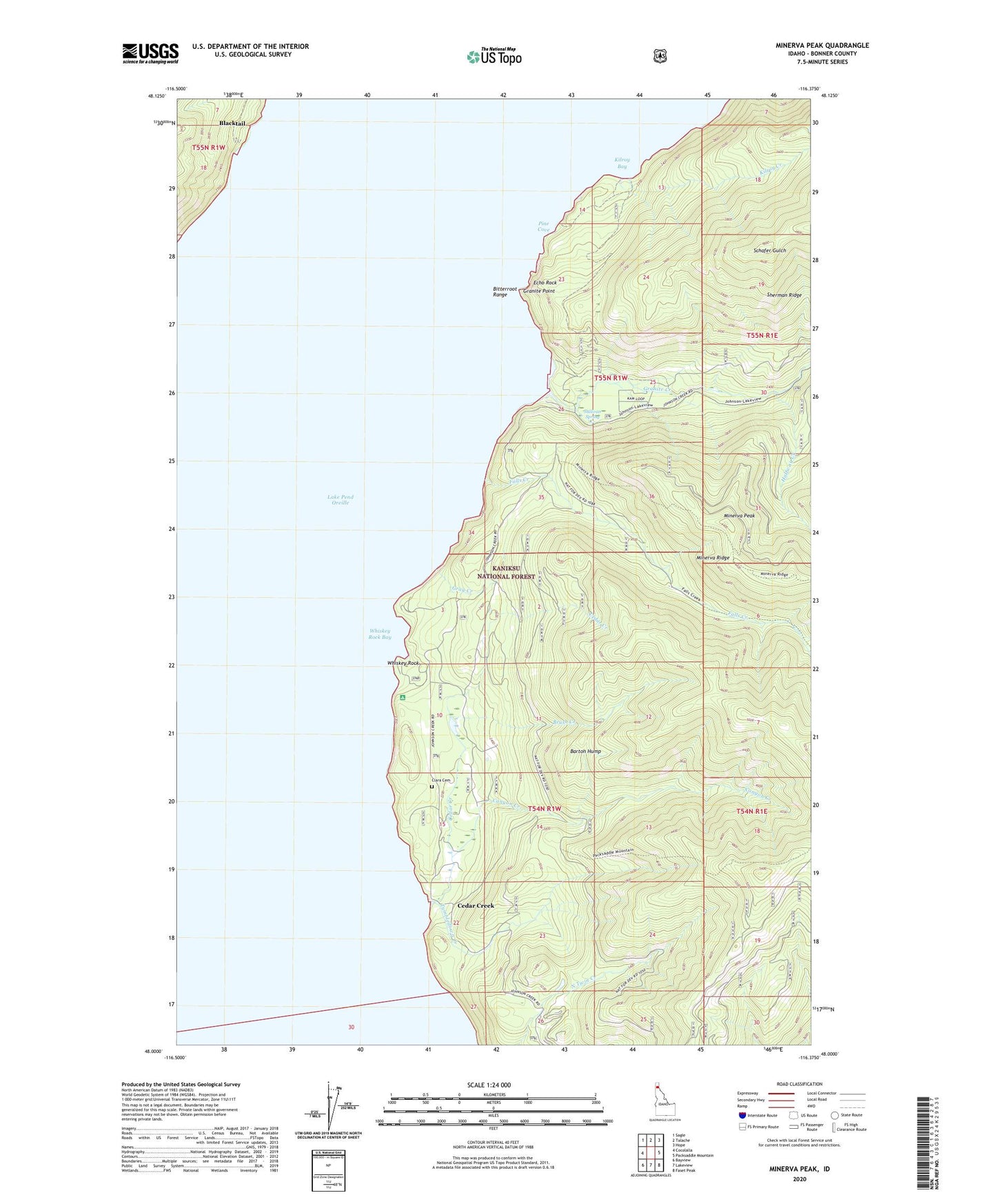
Minerva Peak Idaho US Topo Map
Couldn't load pickup availability
Also explore the Minerva Peak Forest Service Topo of this same quad for updated USFS data
2024 topographic map quadrangle Minerva Peak in the state of Idaho. Scale: 1:24000. Based on the newly updated USGS 7.5' US Topo map series, this map is in the following counties: Bonner. The map contains contour data, water features, and other items you are used to seeing on USGS maps, but also has updated roads and other features. This is the next generation of topographic maps. Printed on high-quality waterproof paper with UV fade-resistant inks.
Quads adjacent to this one:
West: Cocolalla
Northwest: Sagle
North: Talache
Northeast: Hope
East: Packsaddle Mountain
Southeast: Faset Peak
South: Lakeview
Southwest: Bayview
This map covers the same area as the classic USGS quad with code o48116a4.
Contains the following named places: Barton Hump, Blacktail, Brush Creek, Canyon Creek, Cedar Creek, Clara Cemetery, Echo Rock, Falls Creek, Falls Creek Mine, Granite, Granite Creek, Granite Point, Gray Creek, Grey Brothers Lime Quarry, Halfway Creek, Kilroy Bay, Kilroy Creek, Minerva Mine, Minerva Peak, Pine Cove, Schafer Mine, Sherman Ridge, Sullivan Spring, Tumbledown Creek, Tumbledown Guard Station, Whiskey Rock, Whiskey Rock Bay, Whiskey Rock Recreation Site, ZIP Code: 83803