MyTopo
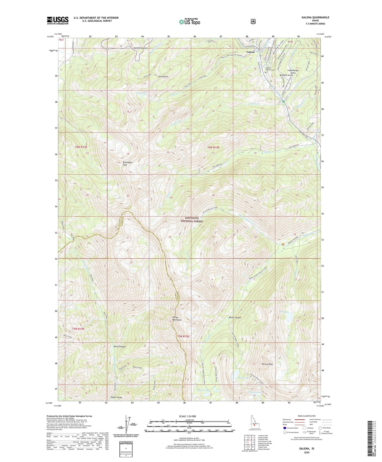
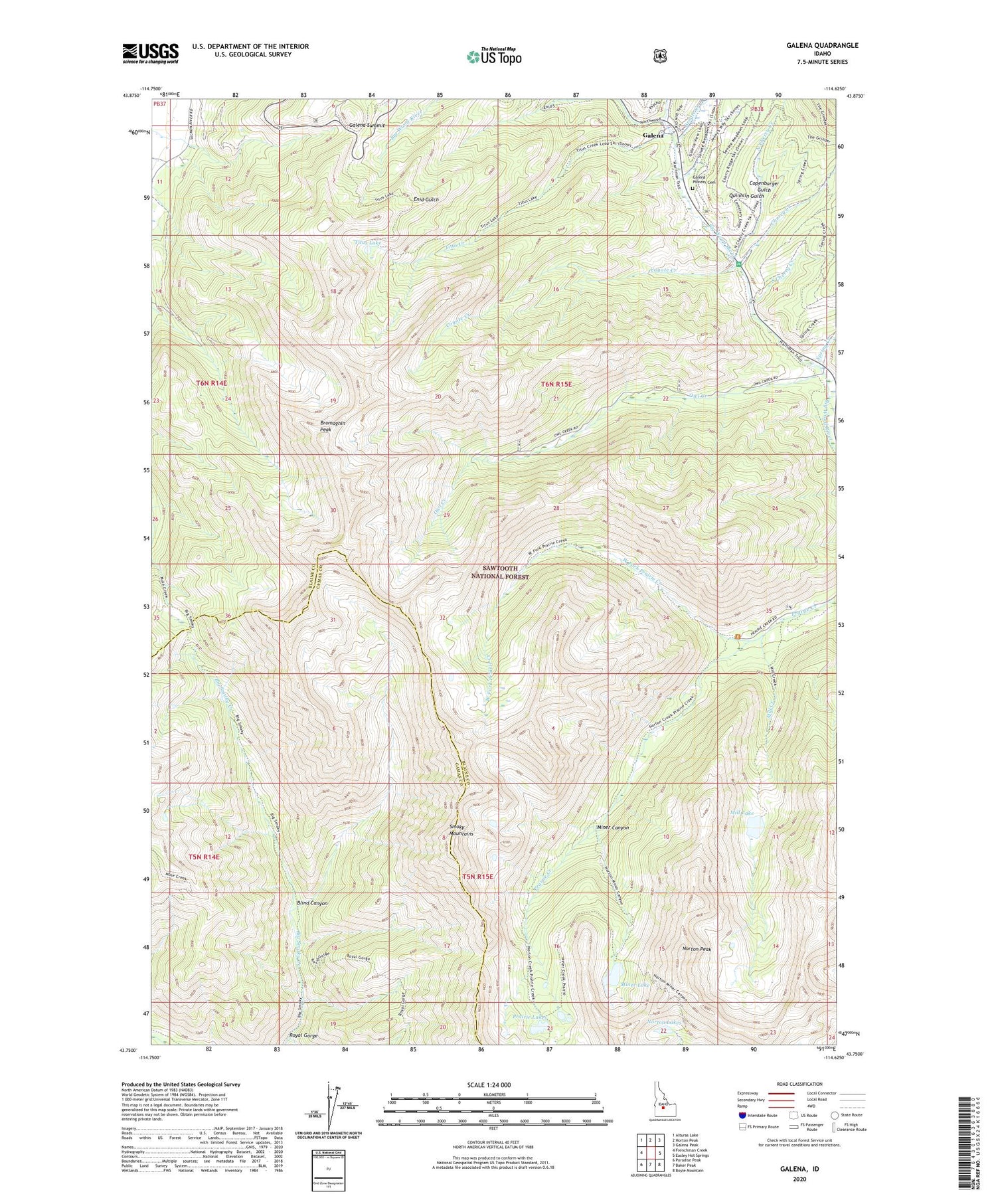
Galena Idaho US Topo Map
Couldn't load pickup availability
Also explore the Galena Forest Service Topo of this same quad for updated USFS data
2024 topographic map quadrangle Galena in the state of Idaho. Scale: 1:24000. Based on the newly updated USGS 7.5' US Topo map series, this map is in the following counties: Blaine, Camas. The map contains contour data, water features, and other items you are used to seeing on USGS maps, but also has updated roads and other features. This is the next generation of topographic maps. Printed on high-quality waterproof paper with UV fade-resistant inks.
Quads adjacent to this one:
West: Frenchman Creek
Northwest: Alturas Lake
North: Horton Peak
Northeast: Galena Peak
East: Easley Hot Springs
Southeast: Boyle Mountain
South: Baker Peak
Southwest: Paradise Peak
This map covers the same area as the classic USGS quad with code o43114g6.
Contains the following named places: Blind Canyon, Bromaghin Peak, Cherry Creek, Copenbarger Gulch, Coyote Creek, Galena, Galena Overlook, Galena Pioneer Cemetery, Galena Summit, Gladiator Creek, King Creek, Mill Creek, Mill Lake, Miner Canyon, Miner Lake, North Cherry Creek, Norton Lakes, Norton Peak, Owl Creek, Prairie Lakes, Quinnlin Gulch, Royal Gorge, Senate Creek, South Cherry Creek, Spring Creek, Titus Creek, Titus Lake, West Fork Prairie Creek