MyTopo
Little Trinity Lake Idaho US Topo Map
Couldn't load pickup availability
Also explore the Little Trinity Lake Forest Service Topo of this same quad for updated USFS data
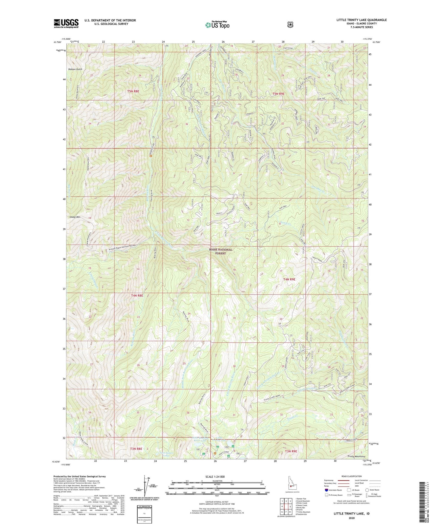
2023 topographic map quadrangle Little Trinity Lake in the state of Idaho. Scale: 1:24000. Based on the newly updated USGS 7.5' US Topo map series, this map is in the following counties: Elmore. The map contains contour data, water features, and other items you are used to seeing on USGS maps, but also has updated roads and other features. This is the next generation of topographic maps. Printed on high-quality waterproof paper with UV fade-resistant inks.
Quads adjacent to this one:
West: Sheep Creek
Northwest: Barber Flat
North: Grand Mountain
Northeast: Phifer Creek
East: Rocky Bar
Southeast: Featherville
South: Trinity Mountain
Southwest: Prairie
This map covers the same area as the classic USGS quad with code o43115f4.
Contains the following named places: Deadman Creek, East Fork Roaring River, Little Roaring River Lake, Little Roaring River Lake Campground, Little Trinity Lake, Little Trinity Lake Campground, Middle Fork Roaring River, Roaring River Trail, Scotch Creek, Sheep Mountain, South Fork Whiskey Jack Creek, Trinity Lakes Guard Station, Trinity Mountains