
MyTopo
Hailey Idaho US Topo Map
Couldn't load pickup availability
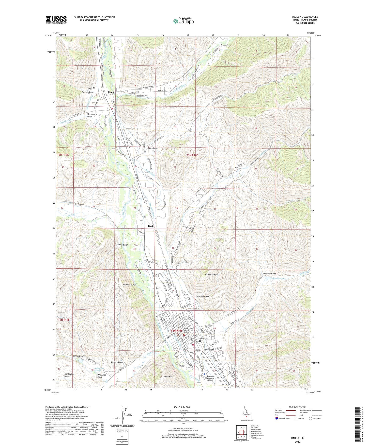
2024 topographic map quadrangle Hailey in the state of Idaho. Scale: 1:24000. Based on the newly updated USGS 7.5' US Topo map series, this map is in the following counties: Blaine. The map contains contour data, water features, and other items you are used to seeing on USGS maps, but also has updated roads and other features. This is the next generation of topographic maps. Printed on high-quality waterproof paper with UV fade-resistant inks.
Quads adjacent to this one:
West: Mahoney Butte
Northwest: Griffin Butte
North: Sun Valley
Northeast: Hyndman Peak
East: Baugh Creek SW
Southeast: Seamans Creek
South: Bellevue
Southwest: Richardson Summit
This map covers the same area as the classic USGS quad with code o43114e3.
Contains the following named places: Barite, Blaine County Sheriff's Office, Carbonate Mountain, City of Hailey, Comstock Ditch, Cove Canal, Croy Creek, Deadman Gulch, Deer Creek, Deer Creek Ranch, Della Mountain, Democrat Gulch, East Fork Wood River, Friedman Memorial Airport, Gimlet, Gimlet Airport, Greenhorn Creek, Greenhorn Gulch, Hailey, Hailey Cemetery, Hailey Elementary School, Hailey Fire Department, Hailey Hot Springs, Hailey Police Department, Hailey Post Office, Hangman Gulch, Hiawatha Canal, Indian Creek, Justus Ditch, Ketchum Fire Department Station 2, KSKI-AM (Hailey), Lambs Gulch, Mizer Ditch, Ohio Gulch, Osborn Gulch, Quigley Creek, Quigley Pond, Red Devil Mountain, Timber Gulch, Vorberg Gulch, Wood River Fire Protection District Station 1, Wood River Fire Protection District Station 2, Wood River High School, Wood River Middle School, ZIP Code: 83333


