MyTopo
Mahoney Butte Idaho US Topo Map
Couldn't load pickup availability
Also explore the Mahoney Butte Forest Service Topo of this same quad for updated USFS data
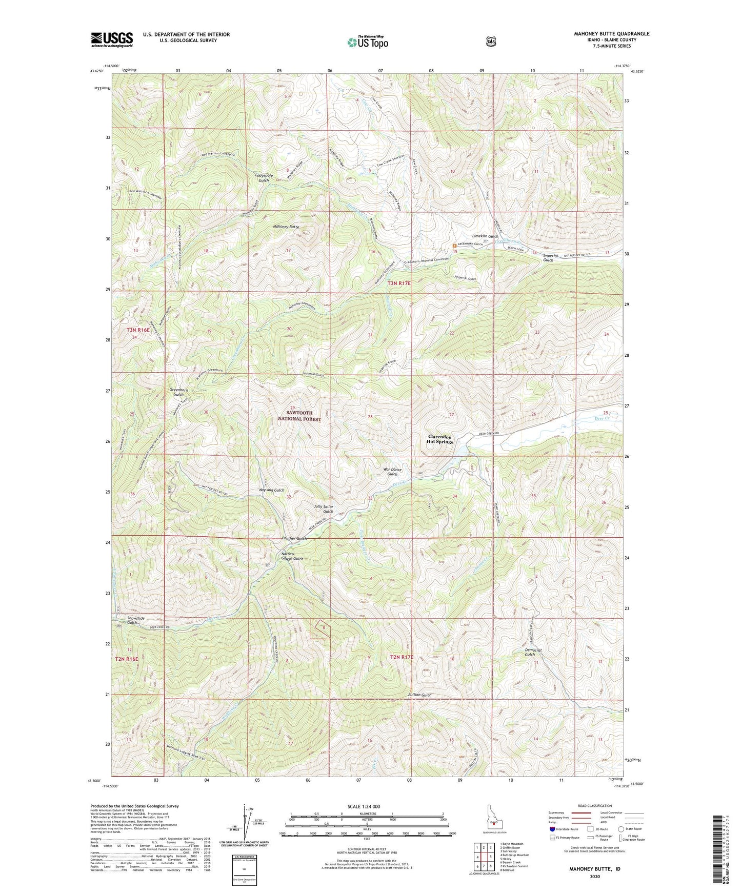
2024 topographic map quadrangle Mahoney Butte in the state of Idaho. Scale: 1:24000. Based on the newly updated USGS 7.5' US Topo map series, this map is in the following counties: Blaine. The map contains contour data, water features, and other items you are used to seeing on USGS maps, but also has updated roads and other features. This is the next generation of topographic maps. Printed on high-quality waterproof paper with UV fade-resistant inks.
Quads adjacent to this one:
West: Buttercup Mountain
Northwest: Boyle Mountain
North: Griffin Butte
Northeast: Sun Valley
East: Hailey
Southeast: Bellevue
South: Richardson Summit
Southwest: Beaver Creek
This map covers the same area as the classic USGS quad with code o43114e4.
Contains the following named places: Bridge Campground, Clarendon Hot Springs, Clarendon Hot Springs Dam, Cow Creek, Democrat Mine, Greenhorn Guard Station, Imperial Gulch, Jimmie Creek, Jolly Sailor Gulch, Limekiln Gulch, Lodgepole Gulch, Mahoney Butte, Mahoney Creek, Narrow Gauge Gulch, Nay Aug Gulch, North Fork Deer Creek, Panther Gulch, Red Cloud Mine, Sawmill Creek, Snowslide Gulch, Twin Bridges Creek, War Dance Gulch, Wolftone Campground, Wolftone Creek