MyTopo
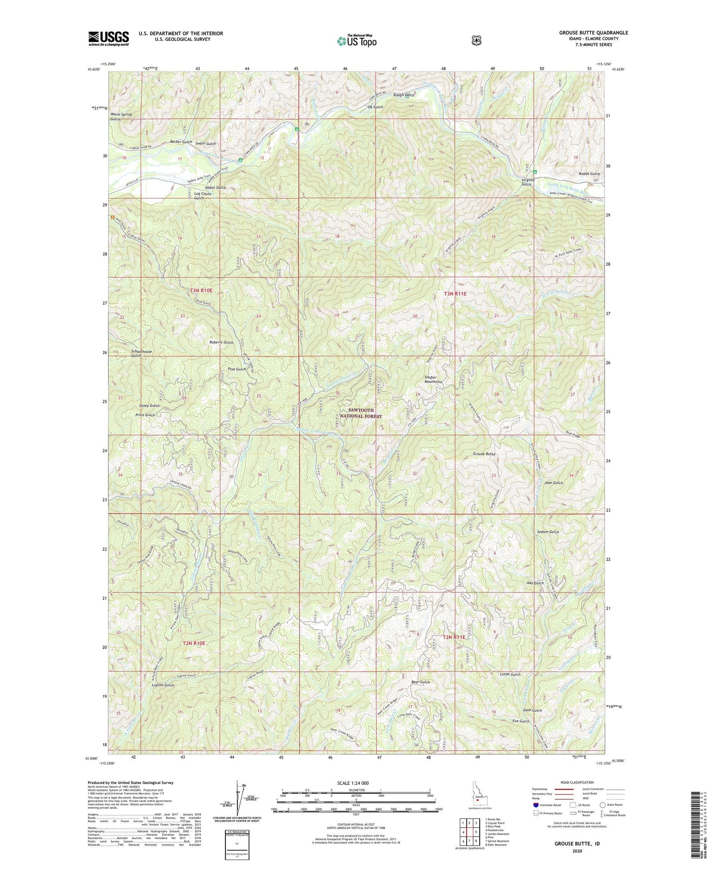
Grouse Butte Idaho US Topo Map
Couldn't load pickup availability
Also explore the Grouse Butte Forest Service Topo of this same quad for updated USFS data
2024 topographic map quadrangle Grouse Butte in the state of Idaho. Scale: 1:24000. Based on the newly updated USGS 7.5' US Topo map series, this map is in the following counties: Elmore. The map contains contour data, water features, and other items you are used to seeing on USGS maps, but also has updated roads and other features. This is the next generation of topographic maps. Printed on high-quality waterproof paper with UV fade-resistant inks.
Quads adjacent to this one:
West: Featherville
Northwest: Rocky Bar
North: Cayuse Point
Northeast: Ross Peak
East: Jumbo Mountain
Southeast: Deer Mountain
South: Sprout Mountain
Southwest: Pine
This map covers the same area as the classic USGS quad with code o43115e2.
Contains the following named places: Abbot Campground, Abbot Gulch, Ada Gulch, Barker Gulch, Bird Creek, Bird Creek Campground, Buckhorn Creek, Burgy Creek, Chaparral Campground, Cold Spring Creek, Fox Gulch, Gem Gulch, Geum Creek, Grouse Butte, Joan Gulch, Kodak Gulch, Log Chute Gulch, Lotah Gulch, Lupine Gulch, Marsh Creek, Middle Fork Grouse Creek, North Fork Grouse Creek, OK Gulch, Regina Creek, Rough Gulch, Sedum Gulch, Shake Creek, Shake Creek Ranger Station, Shake Creek Recreation Site, South Fork Grouse Creek, Swain Gulch, Taylor Creek, Virginia Gulch, Warbois Creek, Warm Spring Gulch, Willow Creek, Willow Creek Campground, Yellow Pine Creek