MyTopo
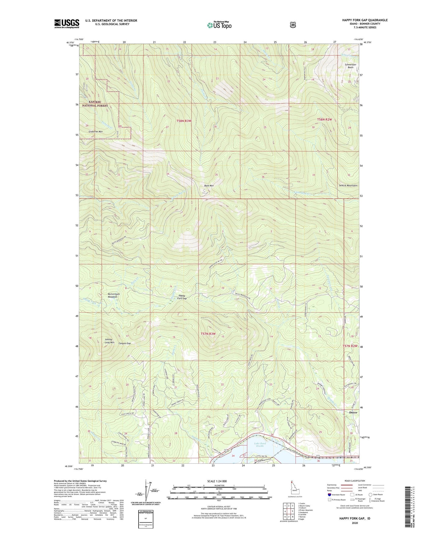
Happy Fork Gap Idaho US Topo Map
Couldn't load pickup availability
Also explore the Happy Fork Gap Forest Service Topo of this same quad for updated USFS data
2024 topographic map quadrangle Happy Fork Gap in the state of Idaho. Scale: 1:24000. Based on the newly updated USGS 7.5' US Topo map series, this map is in the following counties: Bonner. The map contains contour data, water features, and other items you are used to seeing on USGS maps, but also has updated roads and other features. This is the next generation of topographic maps. Printed on high-quality waterproof paper with UV fade-resistant inks.
Quads adjacent to this one:
West: Prater Mountain
Northwest: Coolin
North: Mount Casey
Northeast: Colburn
East: Sandpoint
Southeast: Sagle
South: Morton
Southwest: Laclede
This map covers the same area as the classic USGS quad with code o48116c6.
Contains the following named places: Bald Mountain, Canyon Gap, Carr Creek, Eagle Mountain Outpost, Gisborne Mountain, Gravel Pit, Happy Fork Gap, Hornby Creek, Johnny Long Mountain, Koch Creek, Little Muskrat Lake, McCormack Meadows, Pine Street Ski Area, Schweitzer Basin, Smith Creek