MyTopo
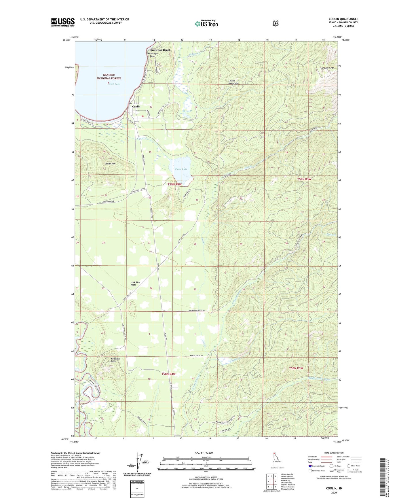
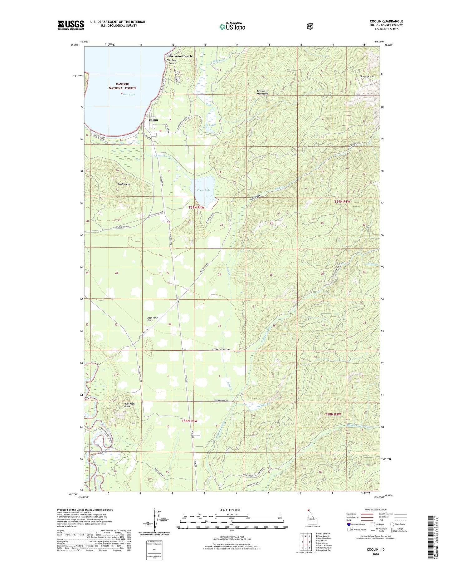
Coolin Idaho US Topo Map
Couldn't load pickup availability
Also explore the Coolin Forest Service Topo of this same quad for updated USFS data
2024 topographic map quadrangle Coolin in the state of Idaho. Scale: 1:24000. Based on the newly updated USGS 7.5' US Topo map series, this map is in the following counties: Bonner. The map contains contour data, water features, and other items you are used to seeing on USGS maps, but also has updated roads and other features. This is the next generation of topographic maps. Printed on high-quality waterproof paper with UV fade-resistant inks.
Quads adjacent to this one:
West: Outlet Bay
Northwest: Priest Lake SW
North: Priest Lake SE
Northeast: Mount Roothaan
East: Mount Casey
Southeast: Happy Fork Gap
South: Prater Mountain
Southwest: Quartz Mountain
This map covers the same area as the classic USGS quad with code o48116d7.
Contains the following named places: Chase Creek, Chase Lake, Chase Lake Access Area, Coolin, Coolin Cavanaugh Bay Fire District, Coolin Census Designated Place, Coolin Mountain, Coolin Post Office, Jack Pine Flats, Junta Creek, Lee Creek, Lee Lake, Lost Creek, Plumbago Point, Sherwood Beach, Sundance Lookout Station, Sundance Mountain, Waters Creek, Whitetail Butte