MyTopo
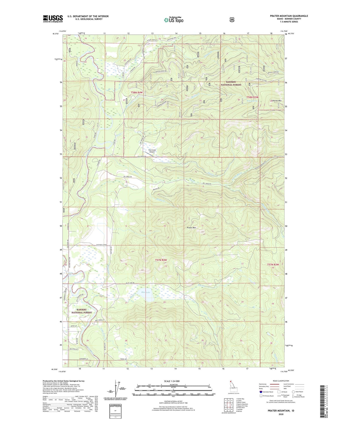
Prater Mountain Idaho US Topo Map
Couldn't load pickup availability
Also explore the Prater Mountain Forest Service Topo of this same quad for updated USFS data
2024 topographic map quadrangle Prater Mountain in the state of Idaho. Scale: 1:24000. Based on the newly updated USGS 7.5' US Topo map series, this map is in the following counties: Bonner. The map contains contour data, water features, and other items you are used to seeing on USGS maps, but also has updated roads and other features. This is the next generation of topographic maps. Printed on high-quality waterproof paper with UV fade-resistant inks.
Quads adjacent to this one:
West: Quartz Mountain
Northwest: Outlet Bay
North: Coolin
Northeast: Mount Casey
East: Happy Fork Gap
Southeast: Morton
South: Laclede
Southwest: Priest River
This map covers the same area as the classic USGS quad with code o48116c7.
Contains the following named places: Benton Creek, Benton Spring, Big Creek, Blue Creek, Blue Lake, Canyon Creek, Canyon Creek Recreational Natural Area, East River, Fox Creek, Fox Creek Airport, Garten Creek, Garten Meadow, Gisbourne Mountain Vista, Happy Fork, Little Pine Creek, McAbee Falls, Middle Fork East River, Mill Creek, North Fork Big Creek, North Fork East River, Prater Creek, Prater Mountain, Priest River Experimental Forest, Priest River Experimental Station, Ranger Creek