MyTopo
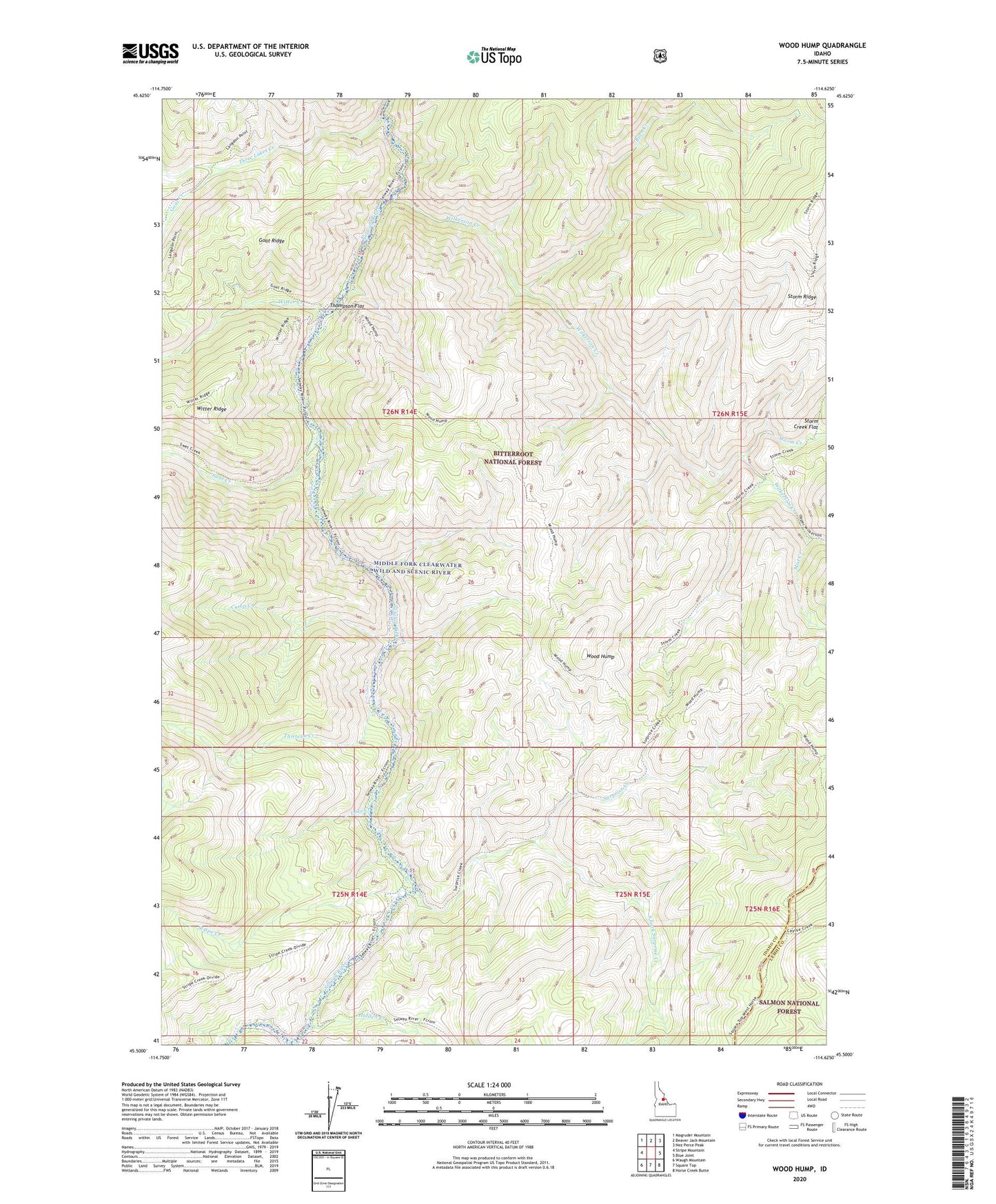
Wood Hump Idaho US Topo Map
Couldn't load pickup availability
Also explore the Wood Hump Forest Service Topo of this same quad for updated USFS data
2024 topographic map quadrangle Wood Hump in the state of Idaho. Scale: 1:24000. Based on the newly updated USGS 7.5' US Topo map series, this map is in the following counties: Idaho, Lemhi. The map contains contour data, water features, and other items you are used to seeing on USGS maps, but also has updated roads and other features. This is the next generation of topographic maps. Printed on high-quality waterproof paper with UV fade-resistant inks.
Quads adjacent to this one:
West: Stripe Mountain
Northwest: Magruder Mountain
North: Beaver Jack Mountain
Northeast: Nez Perce Peak
East: Blue Joint
Southeast: Horse Creek Butte
South: Square Top
Southwest: Waugh Mountain
This map covers the same area as the classic USGS quad with code o45114e6.
Contains the following named places: Burn Creek, Camp Creek, Goat Creek, Hidden Creek, Lake Creek, Mist Creek, South Fork Surprise Creek, Storm Creek, Stripe Creek, Surprise Creek, Surprise Creek Recreation Site, Swet Creek, Thirteen Creek, Thompson Flat, Three Lakes Creek, Wilkerson Creek, Witter Creek, Wood Hump