MyTopo
Juliaetta Idaho US Topo Map
Couldn't load pickup availability
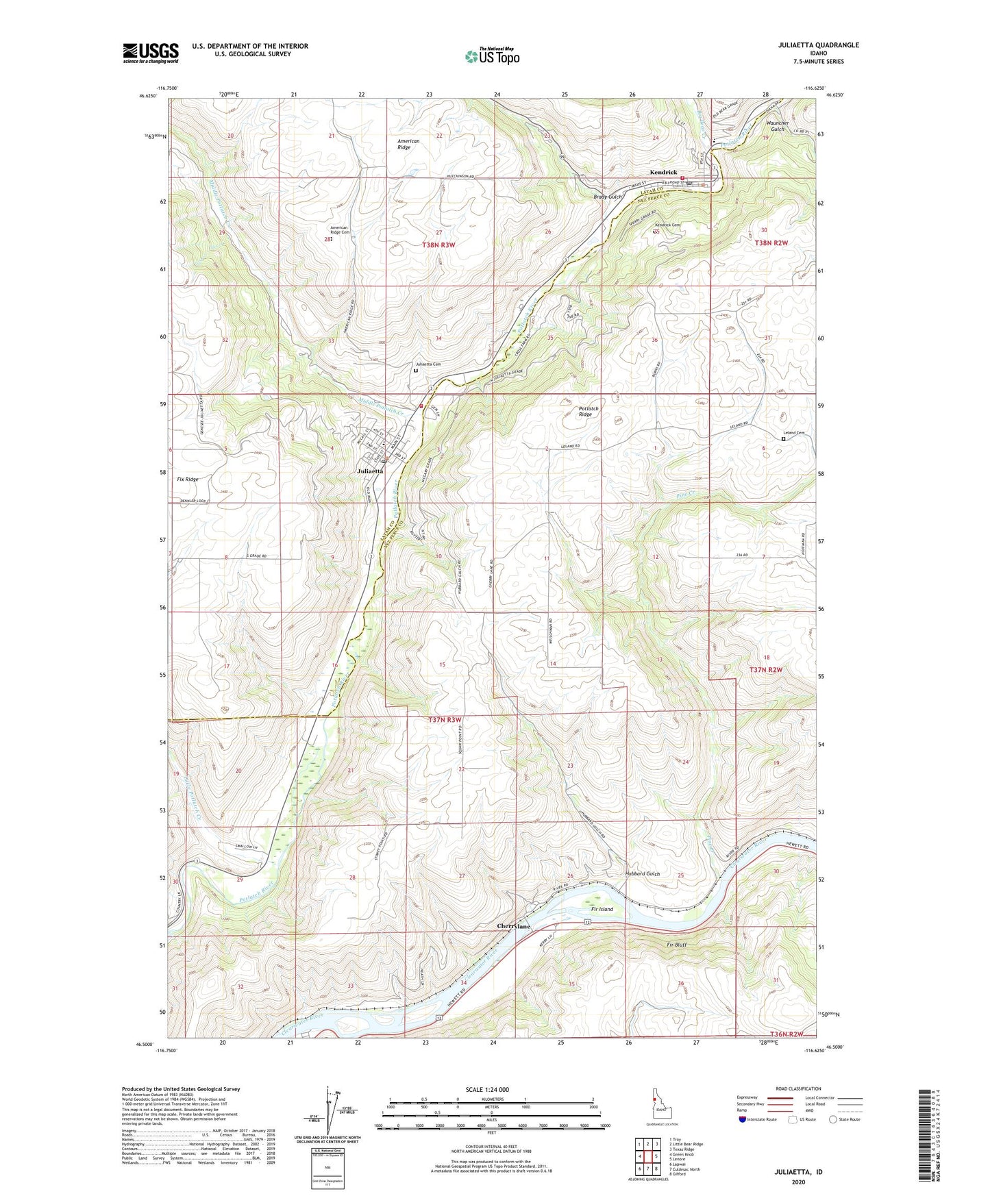
2024 topographic map quadrangle Juliaetta in the state of Idaho. Scale: 1:24000. Based on the newly updated USGS 7.5' US Topo map series, this map is in the following counties: Nez Perce, Latah. The map contains contour data, water features, and other items you are used to seeing on USGS maps, but also has updated roads and other features. This is the next generation of topographic maps. Printed on high-quality waterproof paper with UV fade-resistant inks.
Quads adjacent to this one:
West: Green Knob
Northwest: Troy
North: Little Bear Ridge
Northeast: Texas Ridge
East: Lenore
Southeast: Gifford
South: Culdesac North
Southwest: Lapwai
This map covers the same area as the classic USGS quad with code o46116e6.
Contains the following named places: American Ridge Cemetery, Big Bear Creek, Brady Gulch, Cherrylane, Cherrylane Station, City of Juliaetta, City of Kendrick, Fir Bluff, Fir Bluff Station, Fir Island, Hubbard Gulch, J K Ambulance, Juliaetta, Juliaetta Cemetery, Juliaetta Elementary School, Juliaetta Post Office, Juliaetta Volunteer Fire Department, Kendrick, Kendrick Cemetery, Kendrick Junior - Senior High School, Kendrick Post Office, Kendrick Volunteer Fire Department, Leland Cemetery, Little Potlatch Creek, Middle Potlatch Creek, Orchard Homes, Pine Creek, Wauncher Gulch, ZIP Code: 83535