MyTopo
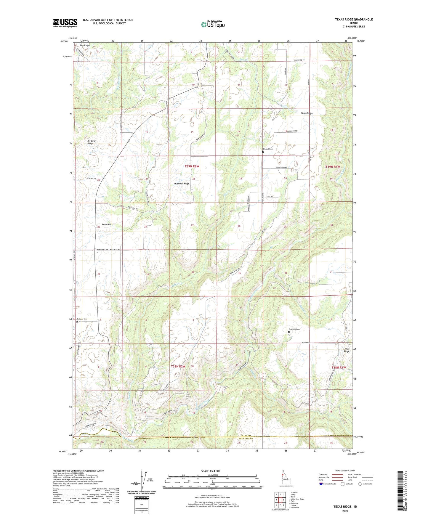
Texas Ridge Idaho US Topo Map
Couldn't load pickup availability
Also explore the Texas Ridge Forest Service Topo of this same quad for updated USFS data
2024 topographic map quadrangle Texas Ridge in the state of Idaho. Scale: 1:24000. Based on the newly updated USGS 7.5' US Topo map series, this map is in the following counties: Latah, Nez Perce. The map contains contour data, water features, and other items you are used to seeing on USGS maps, but also has updated roads and other features. This is the next generation of topographic maps. Printed on high-quality waterproof paper with UV fade-resistant inks.
Quads adjacent to this one:
West: Little Bear Ridge
Northwest: Stanford
North: Deary
Northeast: Bovill
East: Park
Southeast: Southwick
South: Lenore
Southwest: Juliaetta
This map covers the same area as the classic USGS quad with code o46116f5.
Contains the following named places: Bean Hill, Bethany Cemetery, Big Bear Ridge, Boulder Creek, Cedar Creek, Elwood Cemetery, Gold Hill Cemetery, Huffman Ridge, Pine Creek, Rock Creek, Texas Ridge, Wild Rose Cemetery, ZIP Code: 83537