MyTopo
Little Bear Ridge Idaho US Topo Map
Couldn't load pickup availability
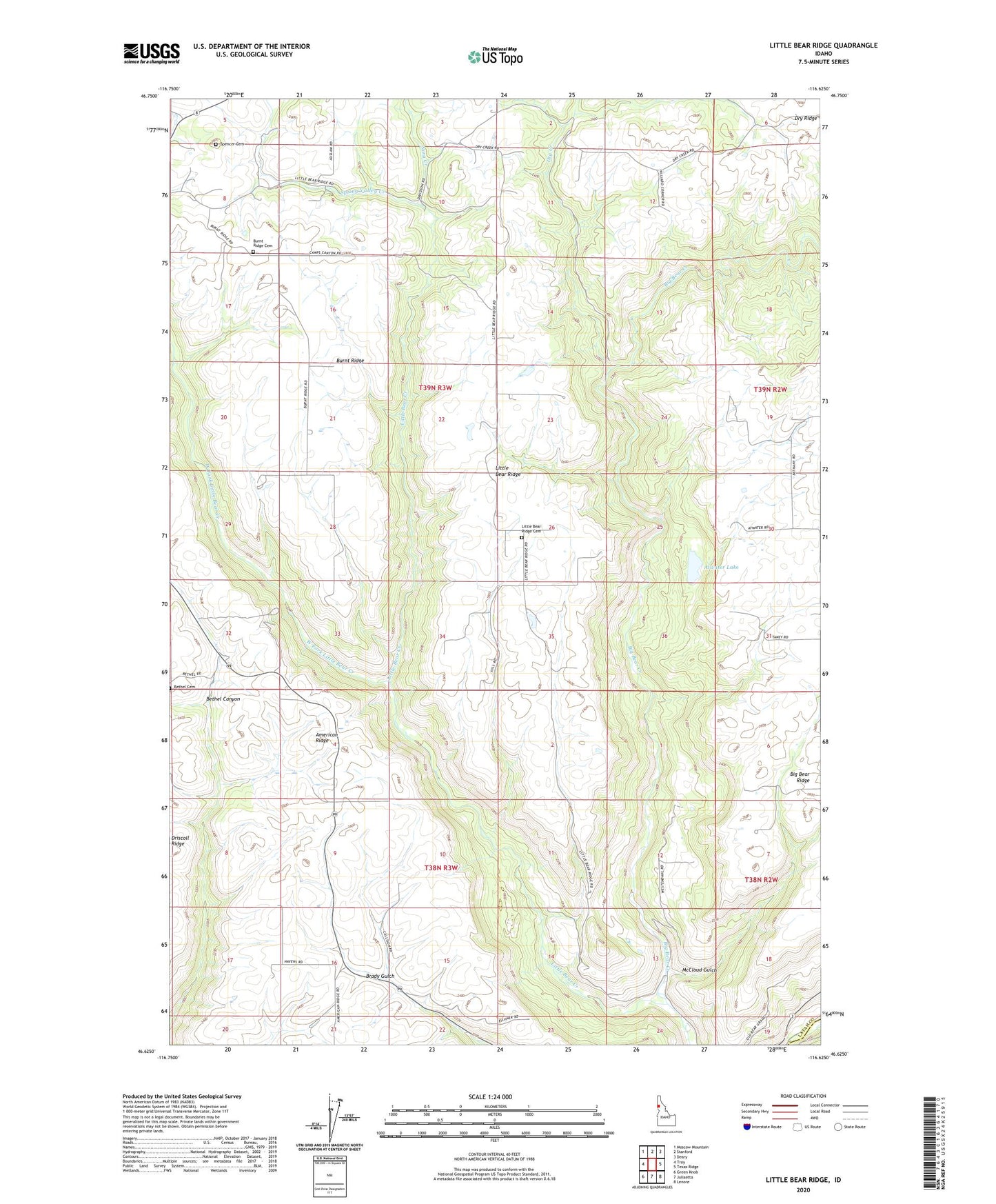
2024 topographic map quadrangle Little Bear Ridge in the state of Idaho. Scale: 1:24000. Based on the newly updated USGS 7.5' US Topo map series, this map is in the following counties: Latah, Nez Perce. The map contains contour data, water features, and other items you are used to seeing on USGS maps, but also has updated roads and other features. This is the next generation of topographic maps. Printed on high-quality waterproof paper with UV fade-resistant inks.
Quads adjacent to this one:
West: Troy
Northwest: Moscow Mountain
North: Stanford
Northeast: Deary
East: Texas Ridge
Southeast: Lenore
South: Juliaetta
Southwest: Green Knob
This map covers the same area as the classic USGS quad with code o46116f6.
Contains the following named places: American Ridge, Atwater Lake, Bovard, Bovard Station, Burnt Ridge, Burnt Ridge Cemetery, Dry Creek, Dry Ridge, Little Bear Creek, Little Bear Ridge, Little Bear Ridge Cemetery, McCloud Gulch, Nora Creek, Spencer Cemetery, Spring Valley Creek, Troy-Juliaetta-Kendrick Division, West Fork Little Bear Creek, ZIP Code: 83871