MyTopo
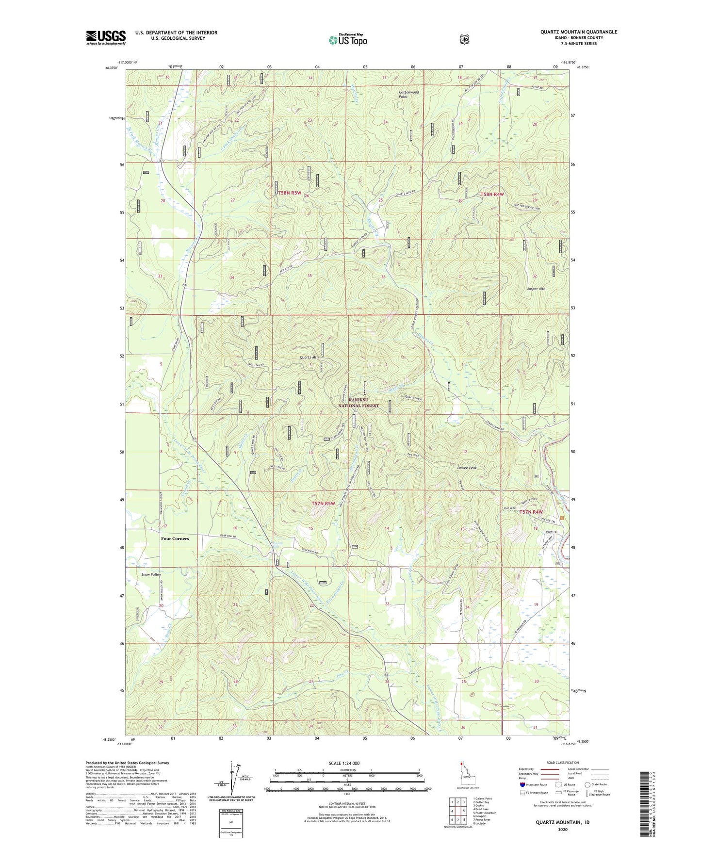
Quartz Mountain Idaho US Topo Map
Couldn't load pickup availability
Also explore the Quartz Mountain Forest Service Topo of this same quad for updated USFS data
2024 topographic map quadrangle Quartz Mountain in the state of Idaho. Scale: 1:24000. Based on the newly updated USGS 7.5' US Topo map series, this map is in the following counties: Bonner. The map contains contour data, water features, and other items you are used to seeing on USGS maps, but also has updated roads and other features. This is the next generation of topographic maps. Printed on high-quality waterproof paper with UV fade-resistant inks.
Quads adjacent to this one:
West: Bead Lake
Northwest: Galena Point
North: Outlet Bay
Northeast: Coolin
East: Prater Mountain
Southeast: Laclede
South: Priest River
Southwest: Newport
This map covers the same area as the classic USGS quad with code o48116c8.
Contains the following named places: Cottonwood Point, East Fork Moores Creek, Falls Ranger Station, Four Corners, Guinn Creek, Jasper Mountain, Kavanaugh Creek, Moores Creek, Peewee Creek, Pewee Peak, Pine Creek, Puzzle Creek, Quartz Creek, Quartz Mountain, Snow Creek, Snow Valley, Snow Valley Academy, Snow Valley Grange, Steep Creek, Torrelle Falls, Tunnel Creek, West Fork Moores Creek, ZIP Code: 83856