MyTopo
Asotin Washington US Topo Map
Couldn't load pickup availability
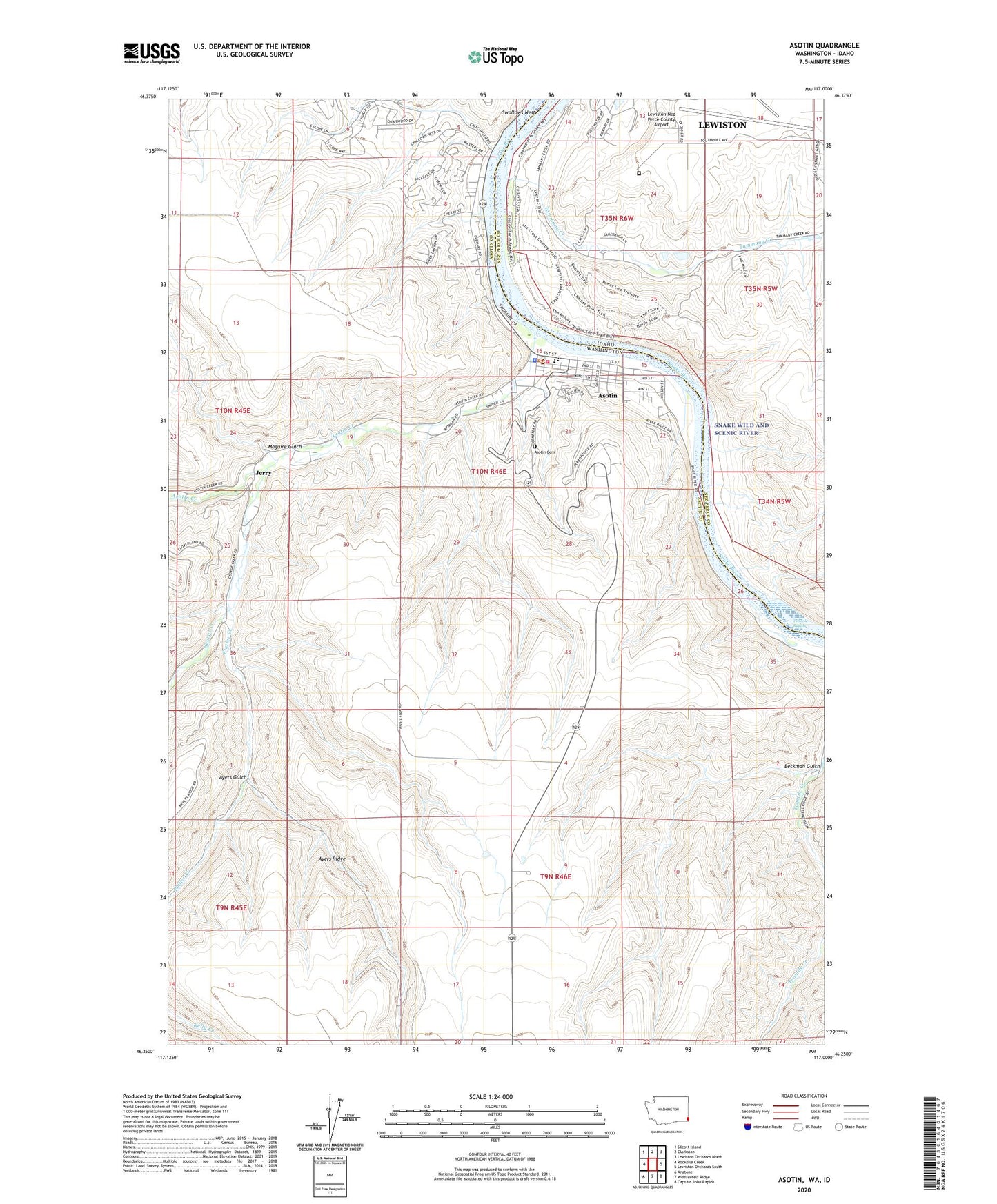
2023 topographic map quadrangle Asotin in the states of Washington, Idaho. Scale: 1:24000. Based on the newly updated USGS 7.5' US Topo map series, this map is in the following counties: Asotin, Nez Perce. The map contains contour data, water features, and other items you are used to seeing on USGS maps, but also has updated roads and other features. This is the next generation of topographic maps. Printed on high-quality waterproof paper with UV fade-resistant inks.
Quads adjacent to this one:
West: Rockpile Creek
Northwest: Silcott Island
North: Clarkston
Northeast: Lewiston Orchards North
East: Lewiston Orchards South
Southeast: Captain John Rapids
South: Weissenfels Ridge
Southwest: Anatone
This map covers the same area as the classic USGS quad with code o46117c1.
Contains the following named places: Airway Park, Asotin, Asotin Cemetery, Asotin County Sheriff's Office, Asotin Creek, Asotin Dam, Asotin Elementary School, Asotin Fire Department, Asotin Junior Senior High School, Asotin Post Office, Ayers Gulch, Ayers Ridge, Beckman Gulch, Chief Lookin Glass Marina, Chief Looking Glass Marina, Chief Looking Glass Park, City of Asotin, Full Gospel Church, George Creek, Hells Gate State Recreation Area, Hells Gato Marina, Idaho State Correction Facility, Jerry, Lewiston-Nez Perce County Airport, Maguire Gulch, Pintler Creek, Swallows Nest, Swallows Nest Golf Club, Tammany Creek, Tenmile Rapids