MyTopo
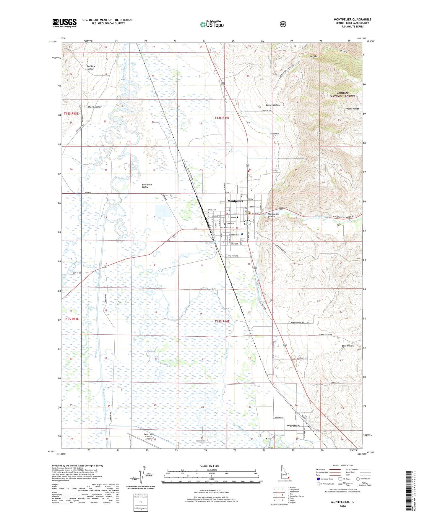
Montpelier Idaho US Topo Map
Couldn't load pickup availability
Also explore the Montpelier Forest Service Topo of this same quad for updated USFS data
2023 topographic map quadrangle Montpelier in the state of Idaho. Scale: 1:24000. Based on the newly updated USGS 7.5' US Topo map series, this map is in the following counties: Bear Lake. The map contains contour data, water features, and other items you are used to seeing on USGS maps, but also has updated roads and other features. This is the next generation of topographic maps. Printed on high-quality waterproof paper with UV fade-resistant inks.
Quads adjacent to this one:
West: Ovid
Northwest: Nounan
North: Georgetown
Northeast: Meade Peak
East: Montpelier Canyon
Southeast: Pegram
South: Dingle
Southwest: Paris
This map covers the same area as the classic USGS quad with code o42111c3.
Contains the following named places: A J Winters Elementary School, Bagley Hollow, Bear Hollow, Bear Lake County, Bear Lake County Ambulance, Bear Lake High School, Bear Lake Memorial Hospital, Bear Lake Middle School, Bear Lake Volunteer Fire Protection District Station 14, City of Montpelier, Dingle Swamp Wildlife Habitat Area, Joes Gap, Kent La Roco Canal, KVSI-AM (Montpelier), Landmark Letter, Montpelier, Montpelier Canyon, Montpelier Creek, Montpelier Fire Department, Montpelier Police Department, Montpelier Post Office, Montpelier Shopping Center, Montpelier Wildlife Management Area, Ovid Creek, Rainbow Dam, Red Pine Hollow, Sheep Hollow, Stewart Dam, Stock Park, Wardboro, ZIP Code: 83254