MyTopo
Menan Buttes Idaho US Topo Map
Couldn't load pickup availability
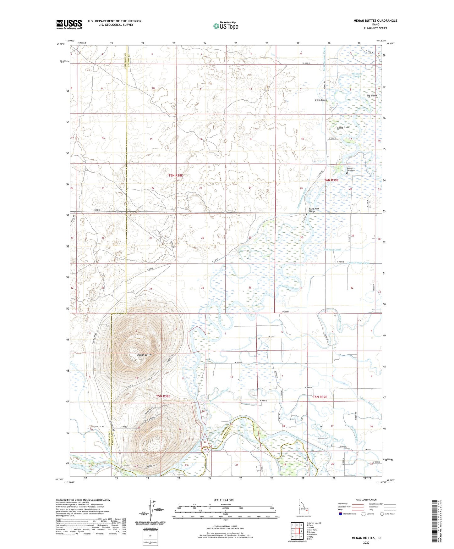
2024 topographic map quadrangle Menan Buttes in the state of Idaho. Scale: 1:24000. Based on the newly updated USGS 7.5' US Topo map series, this map is in the following counties: Madison, Jefferson. The map contains contour data, water features, and other items you are used to seeing on USGS maps, but also has updated roads and other features. This is the next generation of topographic maps. Printed on high-quality waterproof paper with UV fade-resistant inks.
Quads adjacent to this one:
West: Deer Parks
Northwest: Market Lake NE
North: Plano
Northeast: Parker
East: Rexburg
Southeast: Ririe
South: Rigby
Southwest: Lewisville
This map covers the same area as the classic USGS quad with code o43111g8.
Contains the following named places: Austin, Bannock Jim Slough, Beaver Dick Cemetery, Big Island, Cartier Slough, Henrys Fork, Historic Monument Site of First Ferry, Independence, Independence School, Liberty Park Canal, Little Island, Menan Buttes, Millward Slough, North Fork Bridge, Saint Anthony and Independent Canal, Scotts Slough, South Teton River, Spring Slough, Texas Slough