MyTopo
Ririe Idaho US Topo Map
Couldn't load pickup availability
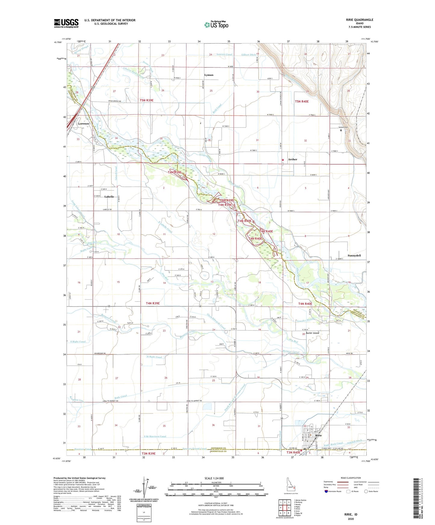
2024 topographic map quadrangle Ririe in the state of Idaho. Scale: 1:24000. Based on the newly updated USGS 7.5' US Topo map series, this map is in the following counties: Jefferson, Madison, Bonneville. The map contains contour data, water features, and other items you are used to seeing on USGS maps, but also has updated roads and other features. This is the next generation of topographic maps. Printed on high-quality waterproof paper with UV fade-resistant inks.
Quads adjacent to this one:
West: Rigby
Northwest: Menan Buttes
North: Rexburg
Northeast: Moody
East: Heise
Southeast: Poplar
South: Rigby SE
Southwest: Ucon
This map covers the same area as the classic USGS quad with code o43111f7.
Contains the following named places: Archer, Archer Elementary School, Central Fire District Station 2, City of Ririe, Clark Edwards Canal, Clark School, Clark Ward Church, Eagle Rock Canal, East Labelle Canal, Enterprise Canal, Farmers Friend Canal, Gilbert Ditch, Island Canal, Labelle, Lenroot Canal, Lorenzo, Lowder Slough, Lyman, Madison Fire Department Station 2, North Rudy Canal, Ririe, Ririe Elementary School, Ririe Junior-Senior High School, Ririe Post Office, Rudy, Rudy Canal, Sidehill Ditch, Sunnydell, Sunnydell Canal, Sutton Cemetery, Union-Lyman Elementary School