MyTopo
Lewisville Idaho US Topo Map
Couldn't load pickup availability
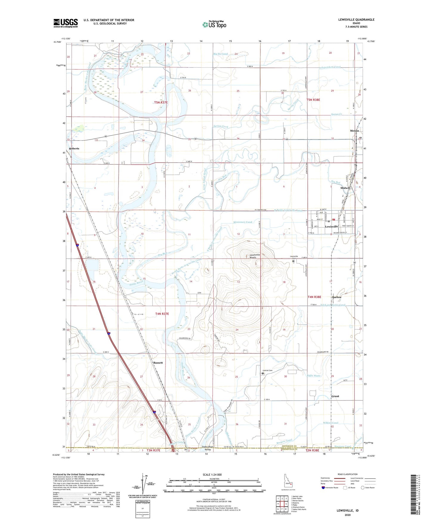
2023 topographic map quadrangle Lewisville in the state of Idaho. Scale: 1:24000. Based on the newly updated USGS 7.5' US Topo map series, this map is in the following counties: Jefferson, Bonneville. The map contains contour data, water features, and other items you are used to seeing on USGS maps, but also has updated roads and other features. This is the next generation of topographic maps. Printed on high-quality waterproof paper with UV fade-resistant inks.
Quads adjacent to this one:
West: Roberts
Northwest: Market Lake
North: Deer Parks
Northeast: Menan Buttes
East: Rigby
Southeast: Ucon
South: Idaho Falls North
Southwest: Shattuck Butte
This map covers the same area as the classic USGS quad with code o43112f1.
Contains the following named places: Barlow, Bassett, Big Six Canal, Butte Market Lake Canal, Central Cemetery, Central Fire District Station 3, City of Lewisville, Deer Park Canal, Dry Bed, Emigrant Creek, Grant, Grant School, Idaho Diversion Dam, Independent Canal, Lewisville, Lewisville Cemetery, Lewisville Knolls, Lewisville Post Office, Lewisville-Menan Division, Menan Post Office, Midway, Midway Elementary School, Midway High School, Midway Middle School, Missionary Canal, Roberts Slough, Spring Creek, Wilkins Canal, ZIP Code: 83431