MyTopo
Rigby Idaho US Topo Map
Couldn't load pickup availability
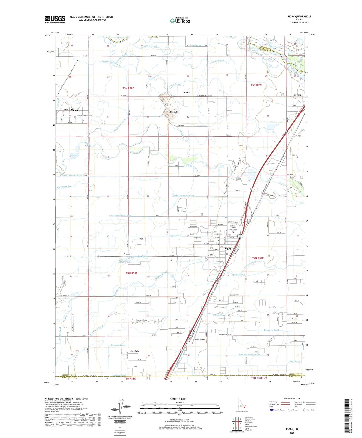
2024 topographic map quadrangle Rigby in the state of Idaho. Scale: 1:24000. Based on the newly updated USGS 7.5' US Topo map series, this map is in the following counties: Jefferson, Madison, Bonneville. The map contains contour data, water features, and other items you are used to seeing on USGS maps, but also has updated roads and other features. This is the next generation of topographic maps. Printed on high-quality waterproof paper with UV fade-resistant inks.
Quads adjacent to this one:
West: Lewisville
Northwest: Deer Parks
North: Menan Buttes
Northeast: Rexburg
East: Ririe
Southeast: Rigby SE
South: Ucon
Southwest: Idaho Falls North
This map covers the same area as the classic USGS quad with code o43111f8.
Contains the following named places: Alliance Canal, Annis, Annis Little Butte Cemetery, Annis Slough, Bungalow Canal, Burgess Canal, Central Fire District Station 1, Central Fire District Station 4, City of Menan, City of Rigby, Garfield, Garfield School, Garfield Ucon Canal, Harrison Canal, Harwood Elementary School, Jefferson County Sheriff's Office, Kinghorn Elementary School, KRIC-FM (Rexburg), Little Buttes, Long Island Canal, Menan, Miller Canal, North Parks Lewisville Canal, North Rigby Canal, Park and Lemon Canal, Parks Lewisville Canal, Randall Canal, Rigby, Rigby Airport, Rigby Canal, Rigby Division, Rigby Middle School, Rigby Pioneer Cemetery, Rigby Post Office, Rigby Senior High School, Rigby Waste, Scotts Slough Canal, Selck and Taylor Canal, Severson Canal, South Parks Lewisville Canal, South Rigby Canal, Vance Payne Canal, ZIP Code: 83442