MyTopo
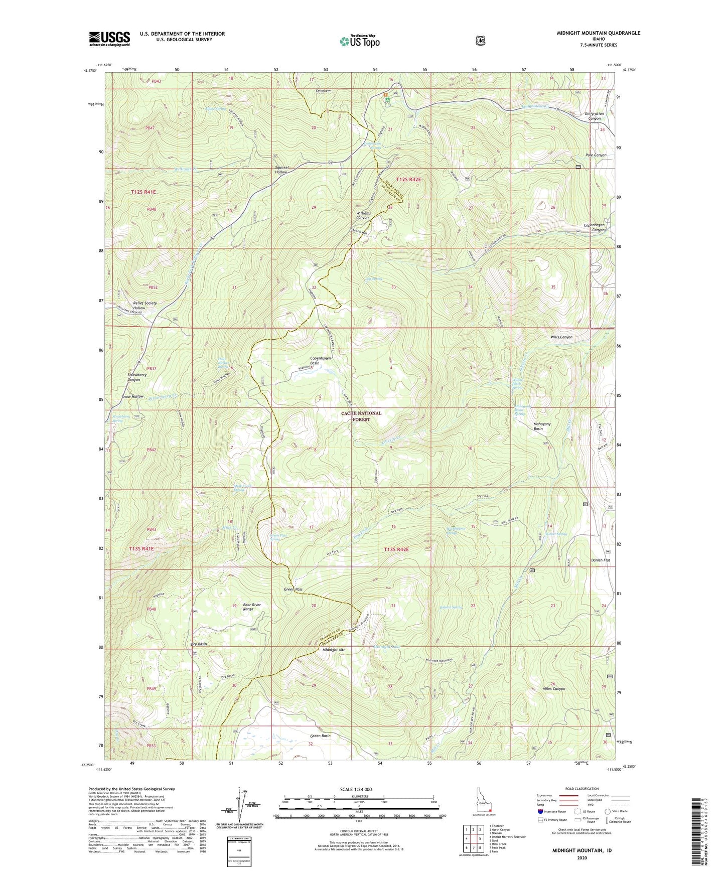
Midnight Mountain Idaho US Topo Map
Couldn't load pickup availability
Also explore the Midnight Mountain Forest Service Topo of this same quad for updated USFS data
2023 topographic map quadrangle Midnight Mountain in the state of Idaho. Scale: 1:24000. Based on the newly updated USGS 7.5' US Topo map series, this map is in the following counties: Bear Lake, Franklin. The map contains contour data, water features, and other items you are used to seeing on USGS maps, but also has updated roads and other features. This is the next generation of topographic maps. Printed on high-quality waterproof paper with UV fade-resistant inks.
Quads adjacent to this one:
West: Oneida Narrows Reservoir
Northwest: Thatcher
North: North Canyon
Northeast: Nounan
East: Ovid
Southeast: Paris
South: Paris Peak
Southwest: Mink Creek
This map covers the same area as the classic USGS quad with code o42111c5.
Contains the following named places: Alpine Spring, Balsam Spring, Copenhagen Basin, Copenhagen Canyon, Danish Flat, Dry Basin, Dry Fork, Emigration Campground, Emigration Canyon, Emigration Spring, Green Basin, Green Pass, Green Pass Spring, Hells Kitchen Spring, Huckleberry Spring, Liberty Creek, Log Spring, Mahogany Basin, Mahogany Basin Spring, Midnight Lake, Midnight Mountain, Mink Creek Spring, Nieber Spring, Pole Canyon, Relief Society Hollow, Snow Hollow, Squirrel Hollow, Strawberry Spring, Willow Patch Spring, Wills Canyon