MyTopo
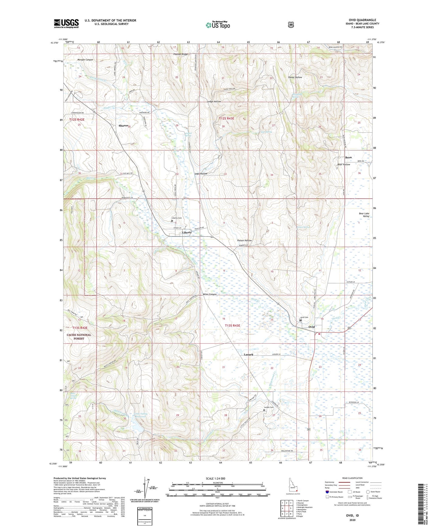
Ovid Idaho US Topo Map
Couldn't load pickup availability
Also explore the Ovid Forest Service Topo of this same quad for updated USFS data
2023 topographic map quadrangle Ovid in the state of Idaho. Scale: 1:24000. Based on the newly updated USGS 7.5' US Topo map series, this map is in the following counties: Bear Lake. The map contains contour data, water features, and other items you are used to seeing on USGS maps, but also has updated roads and other features. This is the next generation of topographic maps. Printed on high-quality waterproof paper with UV fade-resistant inks.
Quads adjacent to this one:
West: Midnight Mountain
Northwest: North Canyon
North: Nounan
Northeast: Georgetown
East: Montpelier
Southeast: Dingle
South: Paris
Southwest: Paris Peak
This map covers the same area as the classic USGS quad with code o42111c4.
Contains the following named places: Bear Hollow, Bear Lake Volunteer Fire Protection District Station 3, Bern, Crystal Spring, Emigration Creek, Hammond Creek, Hammond Dam, Hoopgobel Spring, Jensen Spring, Lanark, Lanark Cemetery, Ledge Hollow, Liberty, Liberty Cemetery, Little Valley Reservoir, Miles Canyon, Miles Canyon Spring, Mill Creek, Morgan Canyon, North Creek, Ovid, Ovid Cemetery, Poison Hollow, Sago Hollow, Sago Spring, Sharon, Snyder Creek, The Dell