MyTopo
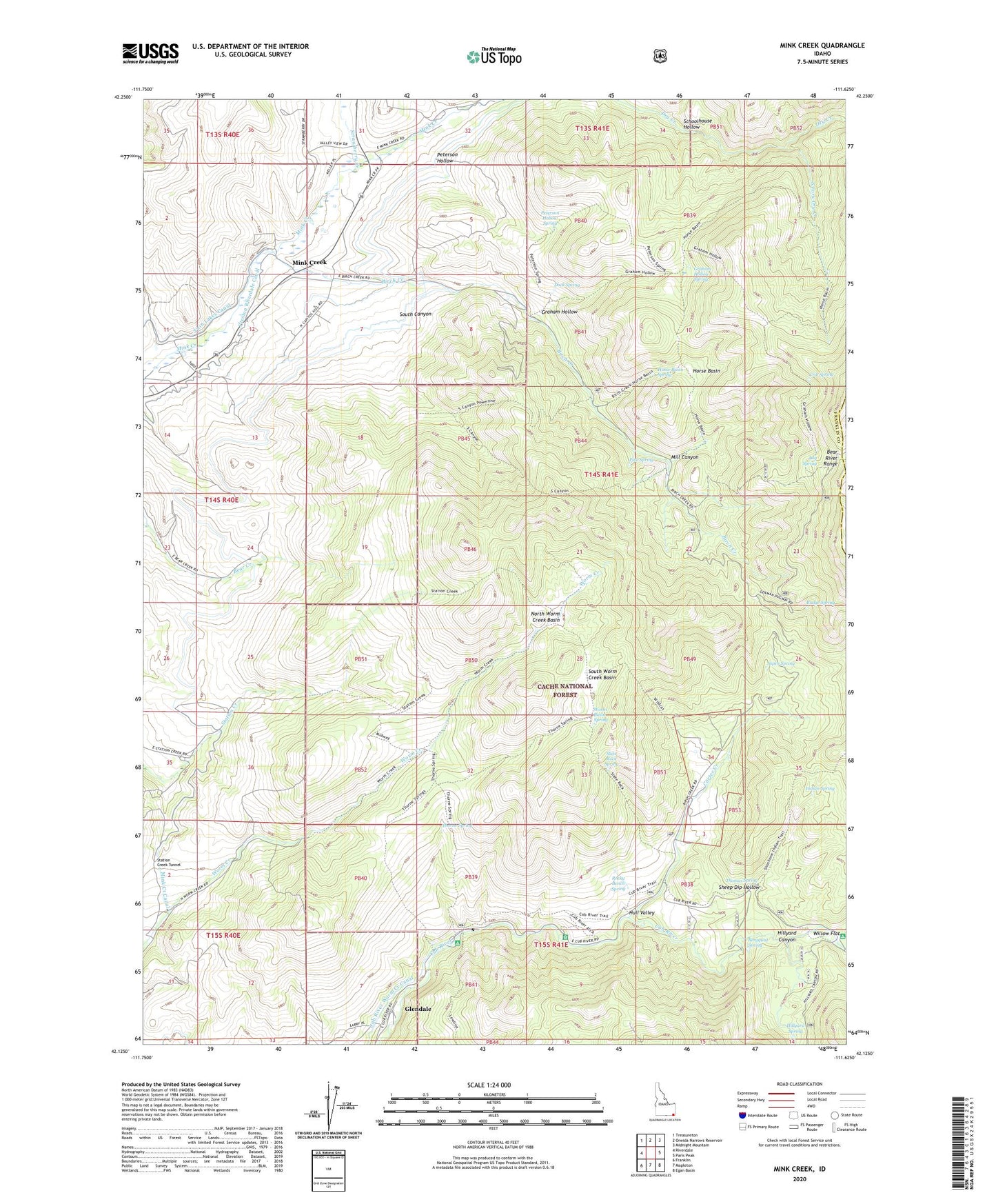
Mink Creek Idaho US Topo Map
Couldn't load pickup availability
Also explore the Mink Creek Forest Service Topo of this same quad for updated USFS data
2023 topographic map quadrangle Mink Creek in the state of Idaho. Scale: 1:24000. Based on the newly updated USGS 7.5' US Topo map series, this map is in the following counties: Franklin, Bear Lake. The map contains contour data, water features, and other items you are used to seeing on USGS maps, but also has updated roads and other features. This is the next generation of topographic maps. Printed on high-quality waterproof paper with UV fade-resistant inks.
Quads adjacent to this one:
West: Riverdale
Northwest: Treasureton
North: Oneida Narrows Reservoir
Northeast: Midnight Mountain
East: Paris Peak
Southeast: Egan Basin
South: Mapleton
Southwest: Franklin
This map covers the same area as the classic USGS quad with code o42111b6.
Contains the following named places: Albert Moser Campground, Aspen Spring, Bergquist Spring, Birch Creek, Budge Spring, Club River Guard Station, Crib Spring, Dock Spring, Glendale, Graham Hollow, Graham Hollow Spring, Hillyard Canyon, Hillyard Spring, Horse Basin, Horse Basin Spring, Hull Valley, Indian Spring, Log Spring, Mill Canyon, Mink Creek, Mink Creek Canal, North Worm Creek Basin, Peterson Hollow, Peterson Hollow Spring, Pine Spring, Rocky Bench Spring, Schoolhouse Hollow, Sheep Dip Hollow, Slate Rock Spring, South Canyon, South Fork Dry Creek, South Worm Creek Basin, Station Creek Tunnel, Strawberry Creek, Thomas Spring, Thorne Spring, Worm Basin Spring