MyTopo
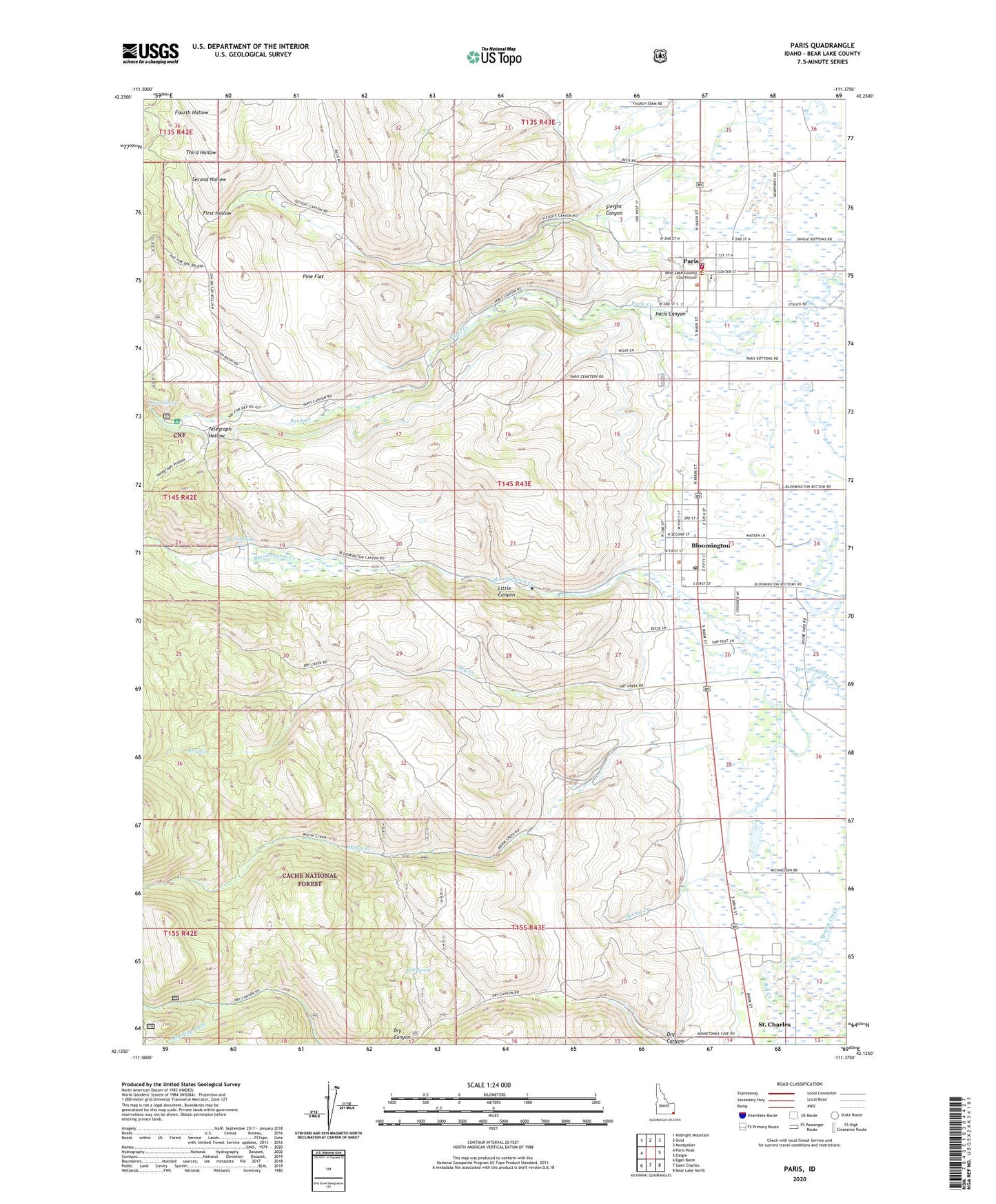
Paris Idaho US Topo Map
Couldn't load pickup availability
Also explore the Paris Forest Service Topo of this same quad for updated USFS data
2023 topographic map quadrangle Paris in the state of Idaho. Scale: 1:24000. Based on the newly updated USGS 7.5' US Topo map series, this map is in the following counties: Bear Lake. The map contains contour data, water features, and other items you are used to seeing on USGS maps, but also has updated roads and other features. This is the next generation of topographic maps. Printed on high-quality waterproof paper with UV fade-resistant inks.
Quads adjacent to this one:
West: Paris Peak
Northwest: Midnight Mountain
North: Ovid
Northeast: Montpelier
East: Dingle
Southeast: Bear Lake North
South: Saint Charles
Southwest: Egan Basin
This map covers the same area as the classic USGS quad with code o42111b4.
Contains the following named places: Bear Lake County Sheriff's Office, Bear Lake Junior High School, Bear Lake Volunteer Fire Protection District Station 1, Big Creek, Bloomington, Bloomington Cemetery, Bloomington Post Office, Boulder Mine, City of Bloomington, City of Paris, Clark Mine, Crib Spring, Dry Creek, Emerson School, First Hollow, Fourth Hollow, Jarvis Spring, Limekiln Fork, Little Canyon, Paris, Paris Canyon, Paris Division, Paris Elementary School, Paris Post Office, Paris Spring, Pine Flat, Second Hollow, Sleight Canyon, Telegraph Hollow, Third Hollow, Worm Creek, ZIP Codes: 83223, 83261