MyTopo
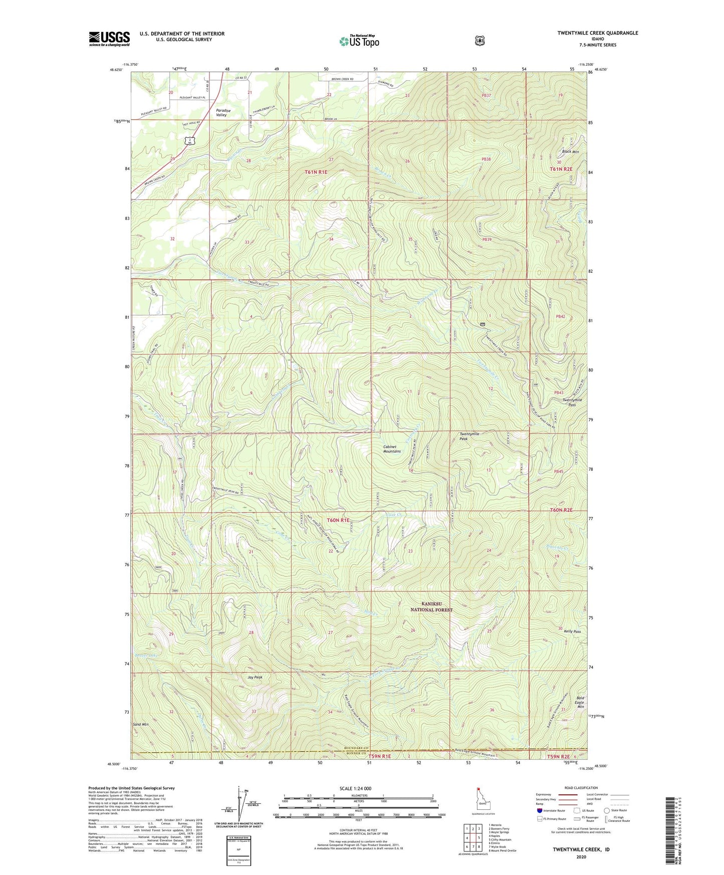
Twentymile Creek Idaho US Topo Map
Couldn't load pickup availability
Also explore the Twentymile Creek Forest Service Topo of this same quad for updated USFS data
2024 topographic map quadrangle Twentymile Creek in the state of Idaho. Scale: 1:24000. Based on the newly updated USGS 7.5' US Topo map series, this map is in the following counties: Boundary, Bonner. The map contains contour data, water features, and other items you are used to seeing on USGS maps, but also has updated roads and other features. This is the next generation of topographic maps. Printed on high-quality waterproof paper with UV fade-resistant inks.
Quads adjacent to this one:
West: Naples
Northwest: Moravia
North: Bonners Ferry
Northeast: Moyie Springs
East: Clifty Mountain
Southeast: Mount Pend Oreille
South: Wylie Knob
Southwest: Elmira
This map covers the same area as the classic USGS quad with code o48116e3.
Contains the following named places: Bald Eagle Mountain, Beaver Lake, Beaver Lake Trail, Black Mountain, Black Mountain Lookout, Cone Creek, Contrary Creek, Grouse Mountain Trail, Jay Peak, Kelly Pass, Sand Mountain, Seed Creek, Twentymile Pass, Twentymile Peak, Upper North Fork Grouse Creek Trail, Wishbone Creek