MyTopo
Moores Hollow Oregon US Topo Map
Couldn't load pickup availability
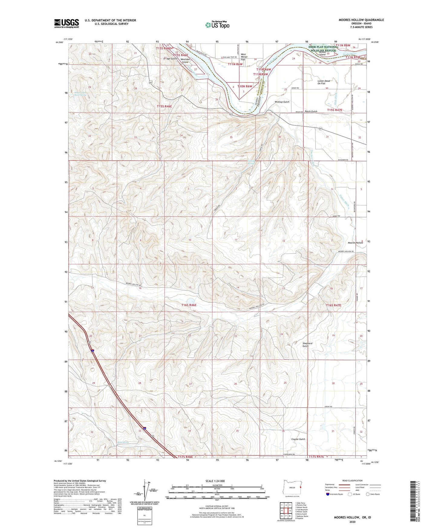
2024 topographic map quadrangle Moores Hollow in the states of Oregon, Idaho. Scale: 1:24000. Based on the newly updated USGS 7.5' US Topo map series, this map is in the following counties: Malheur, Washington. The map contains contour data, water features, and other items you are used to seeing on USGS maps, but also has updated roads and other features. This is the next generation of topographic maps. Printed on high-quality waterproof paper with UV fade-resistant inks.
Quads adjacent to this one:
West: Tub Mountain
Northwest: Olds Ferry
North: Porters Flat
Northeast: Weiser North
East: Weiser South
Southeast: Payette
South: Malheur Butte
Southwest: Henry Gulch
This map covers the same area as the classic USGS quad with code o44117b1.
Contains the following named places: Bridge Gulch, Jenkins Creek, King Spring, Lower Dead Ox Flat, McRea Island, Moores Hollow, Patch Gulch, Slide Ditch, Westlake Island, Wheel Gulch Basin Spring, Wickiup Gulch, Wickiup Springs