MyTopo
Wilder Idaho US Topo Map
Couldn't load pickup availability
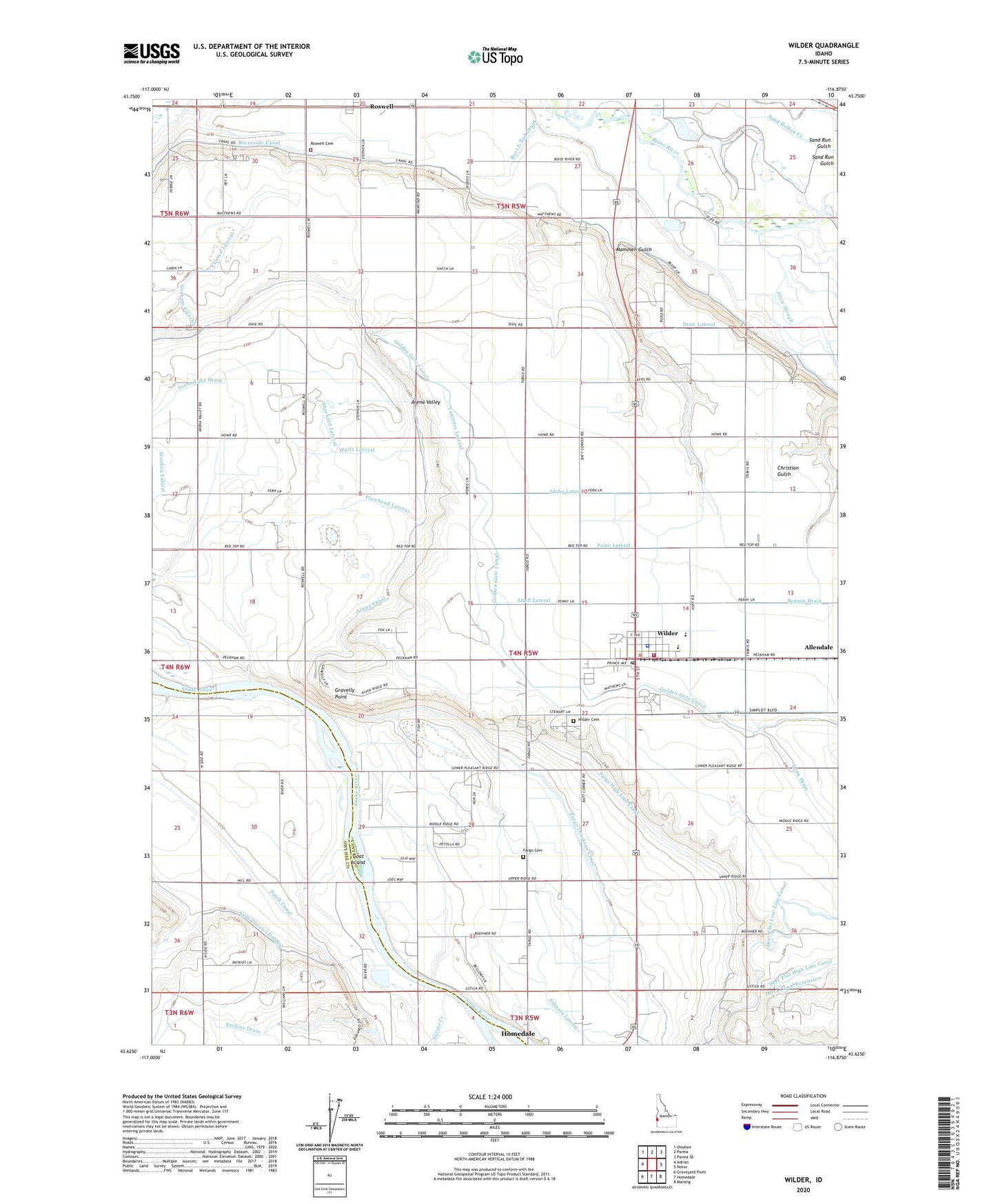
2023 topographic map quadrangle Wilder in the state of Idaho. Scale: 1:24000. Based on the newly updated USGS 7.5' US Topo map series, this map is in the following counties: Canyon, Owyhee. The map contains contour data, water features, and other items you are used to seeing on USGS maps, but also has updated roads and other features. This is the next generation of topographic maps. Printed on high-quality waterproof paper with UV fade-resistant inks.
Quads adjacent to this one:
West: Adrian
Northwest: Owyhee
North: Parma
Northeast: Parma SE
East: Notus
Southeast: Marsing
South: Homedale
Southwest: Graveyard Point
This map covers the same area as the classic USGS quad with code o43116f8.
Contains the following named places: Andrews Ditch, Arena Canal, Arena Lake Drain, Attell Lateral, Benson Drain, City of Wilder, Dixie Access Area, Dixie Slough, Drew Drain, Drew Lateral, East Alkali Drain, Fargo Cemetery, Fargo High Line Canal, Fargo Low Line Canal, Four-H Adventure Club, Gem District D Canal, Goat Island, Golden Gate Canal, Gravelly Point, Heltons Island, Holmes Elementary School, Idaho Lateral, Johnson Lateral, Kilbaine Lateral, Mammen Gulch, Paine Lateral, Parkins Drain, Patch Canal, Plowhead Lateral, Ross Lateral, Roswell, Roswell Cemetery, Sheckard Lateral, Succor Creek, Vantress Lateral, Watts Lateral, Wilder, Wilder Cemetery, Wilder Division, Wilder Head Start, Wilder Middle - High School, Wilder Police Department, Wilder Post Office, Wilder Rural Fire Protection District, Wordica Lateral, ZIP Code: 83676