MyTopo
Adrian Oregon US Topo Map
Couldn't load pickup availability
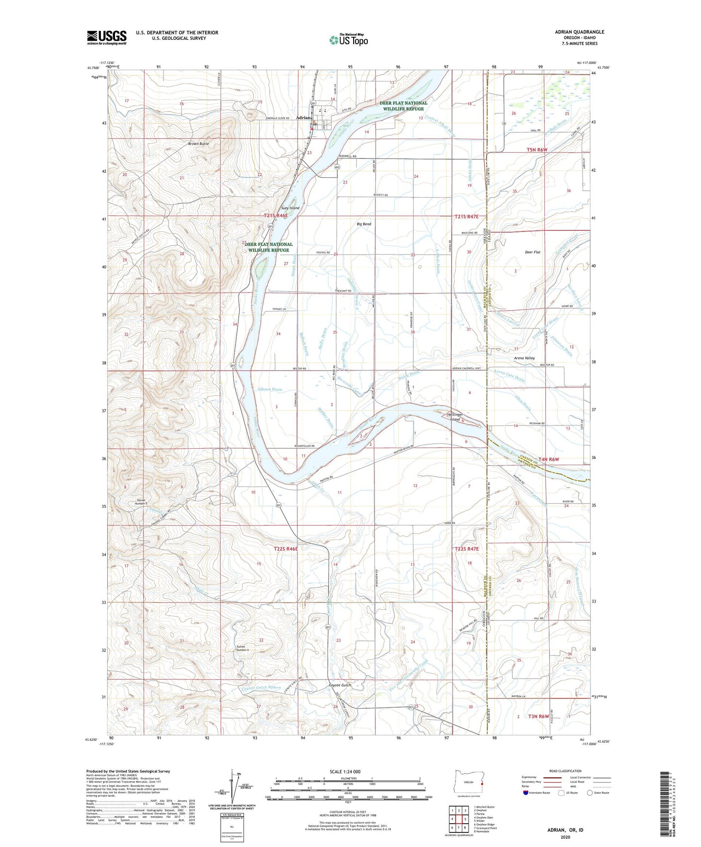
2023 topographic map quadrangle Adrian in the states of Oregon, Idaho. Scale: 1:24000. Based on the newly updated USGS 7.5' US Topo map series, this map is in the following counties: Malheur, Canyon, Owyhee. The map contains contour data, water features, and other items you are used to seeing on USGS maps, but also has updated roads and other features. This is the next generation of topographic maps. Printed on high-quality waterproof paper with UV fade-resistant inks.
Quads adjacent to this one:
West: Owyhee Dam
Northwest: Mitchell Butte
North: Owyhee
Northeast: Parma
East: Wilder
Southeast: Homedale
South: Graveyard Point
Southwest: Owyhee Ridge
This map covers the same area as the classic USGS quad with code o43117f1.
Contains the following named places: Adrian, Adrian Boat Launch, Adrian Division, Adrian Elementary School, Adrian Fire Department, Adrian High School, Adrian Post Office, Alkali Creek, Allen Drain, Arena Case Drain, Arena Valley, Big Bend, Big Bend Park, Big Bend School, Brown Butte, Bullock Drain, Central Alkali Drain, Chance Lateral, City of Adrian, Coyote Gulch, Coyote Gulch Siphon, Deer Flat, Five and Seventenths Canal, Gibson Drain, Golden Gate Canal, Graham Lateral, Hettinger Island, Holly Drain, Imbler Drain, Johanson Drain, Magoffin, Napton, North Alkali Creek, North Oakander Drain, Oakander Drain, Red Drain, Riverside Canal, Rowell Marsh Wildlife Habitat Area, Singer Drain, South Alkali Drain, South Canal, Stradley Drain, Suzy Island, Tunnel Number 6, Walker Drain, Welch Drain