MyTopo
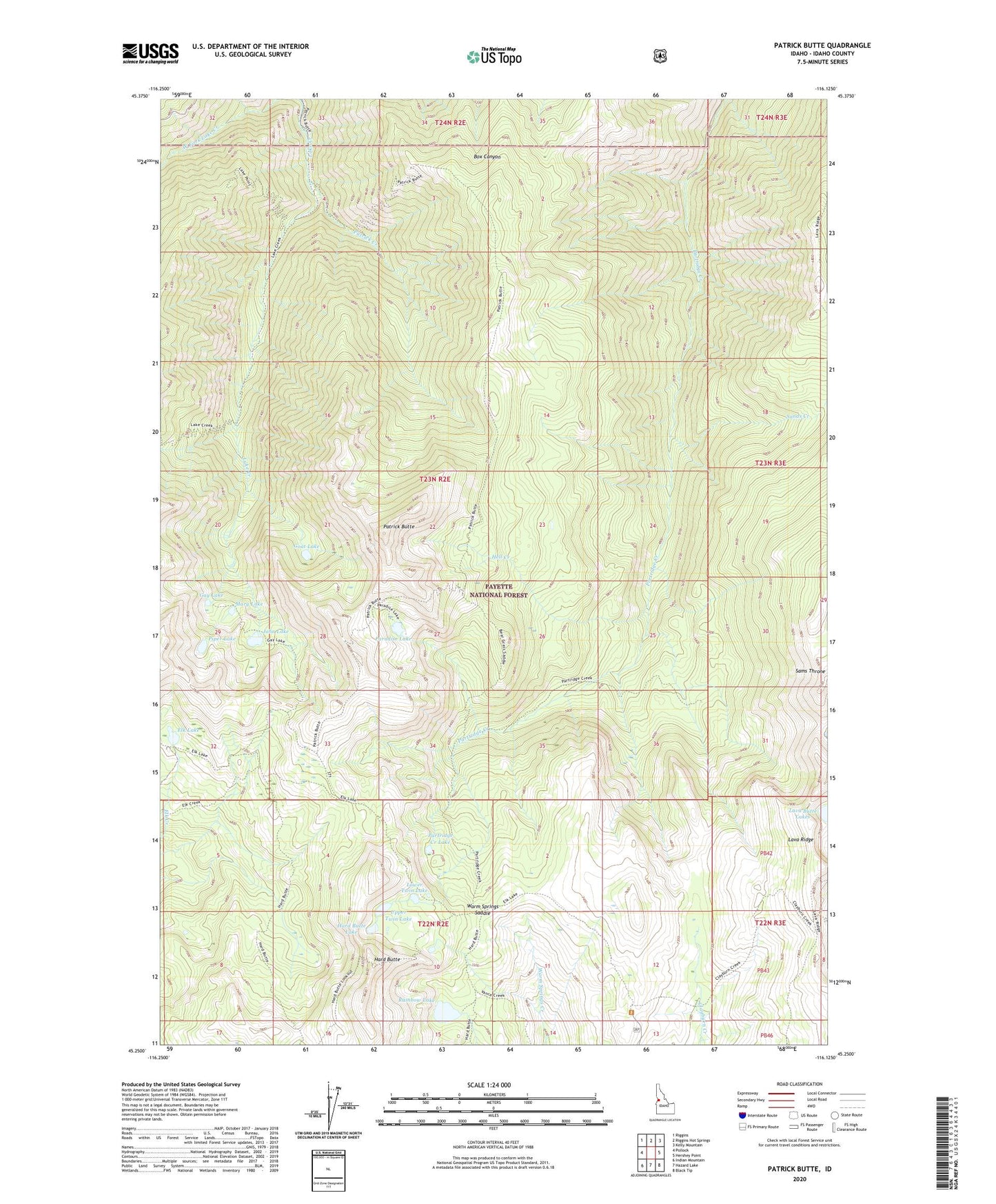
Patrick Butte Idaho US Topo Map
Couldn't load pickup availability
Also explore the Patrick Butte Forest Service Topo of this same quad for updated USFS data
2024 topographic map quadrangle Patrick Butte in the state of Idaho. Scale: 1:24000. Based on the newly updated USGS 7.5' US Topo map series, this map is in the following counties: Idaho. The map contains contour data, water features, and other items you are used to seeing on USGS maps, but also has updated roads and other features. This is the next generation of topographic maps. Printed on high-quality waterproof paper with UV fade-resistant inks.
Quads adjacent to this one:
West: Pollock
Northwest: Riggins
North: Riggins Hot Springs
Northeast: Kelly Mountain
East: Hershey Point
Southeast: Black Tip
South: Hazard Lake
Southwest: Indian Mountain
This map covers the same area as the classic USGS quad with code o45116c2.
Contains the following named places: Elk Lake, Gay Lake, Goat Lake, Hard Butte, Hard Butte Lake, Hell Creek, John Lake, Lava Ridge, Lower Twin Lake, Mary Lake, Paradise Lake, Partridge Creek Lake, Patrick Butte, Patrick Creek, Piper Lake, Rainbow Lake, Sams Throne, Sands Creek, Upper Twin Lake, Warm Springs Saddle, ZIP Code: 83549